
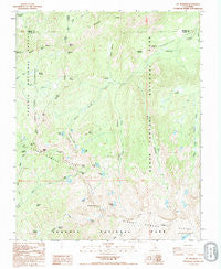
~ Mt Silliman CA topo map, 1:24000 scale, 7.5 X 7.5 Minute, Historical, 1993, updated 1995
Mt Silliman, California, USGS topographic map dated 1993.
Includes geographic coordinates (latitude and longitude). This topographic map is suitable for hiking, camping, and exploring, or framing it as a wall map.
Printed on-demand using high resolution imagery, on heavy weight and acid free paper, or alternatively on a variety of synthetic materials.
Topos available on paper, Waterproof, Poly, or Tyvek. Usually shipping rolled, unless combined with other folded maps in one order.
- Product Number: USGS-5519263
- Free digital map download (high-resolution, GeoPDF): Mt Silliman, California (file size: 13 MB)
- Map Size: please refer to the dimensions of the GeoPDF map above
- Weight (paper map): ca. 55 grams
- Map Type: POD USGS Topographic Map
- Map Series: HTMC
- Map Verison: Historical
- Cell ID: 30809
- Scan ID: 293354
- Imprint Year: 1995
- Woodland Tint: Yes
- Visual Version Number: 1
- Aerial Photo Year: 1993
- Datum: NAD27
- Map Projection: Lambert Conformal Conic
- Provisional map: Yes
- Map published by United States Geological Survey
- Map Language: English
- Scanner Resolution: 600 dpi
- Map Cell Name: Mount Silliman
- Grid size: 7.5 X 7.5 Minute
- Date on map: 1993
- Map Scale: 1:24000
- Geographical region: California, United States
Neighboring Maps:
All neighboring USGS topo maps are available for sale online at a variety of scales.
Spatial coverage:
Topo map Mt Silliman, California, covers the geographical area associated the following places:
- Profile View - Silliman Crest - Box Canyon - Twin Lakes - Belle Canyon - Pond Meadow - Little Lakes - South Fork Sugarloaf Creek - West Fork Clover Creek - Kanawyer Gap - Little Lake - Pattee Meadow - East Fork Sugarloaf Creek - Marvin Pass - Mount Silliman - Sugarloaf Valley - Comanche Meadow - Ferguson Creek - Twin Peaks - Ranger Lake - Silliman Lake - Ellis Meadow - Beville Lake - Rowell Meadow - Sugarloaf - Sugarloaf Meadow - Sheep Camp Lakes - Mitchell Peak - Seville Lake - Silliman Meadow - Ball Dome - East Fork Clover Creek - Kettle Peak - Lost Lake - Crescent Lake - Crowley Canyon - Mount Maddox - Cahoon Gap - Williams Meadow - Silliman Pass - J.O. Pass
- Map Area ID: AREA36.7536.625-118.75-118.625
- Northwest corner Lat/Long code: USGSNW36.75-118.75
- Northeast corner Lat/Long code: USGSNE36.75-118.625
- Southwest corner Lat/Long code: USGSSW36.625-118.75
- Southeast corner Lat/Long code: USGSSE36.625-118.625
- Northern map edge Latitude: 36.75
- Southern map edge Latitude: 36.625
- Western map edge Longitude: -118.75
- Eastern map edge Longitude: -118.625


