
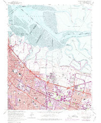
~ Mountain View CA topo map, 1:24000 scale, 7.5 X 7.5 Minute, Historical, 1961, updated 1975
Mountain View, California, USGS topographic map dated 1961.
Includes geographic coordinates (latitude and longitude). This topographic map is suitable for hiking, camping, and exploring, or framing it as a wall map.
Printed on-demand using high resolution imagery, on heavy weight and acid free paper, or alternatively on a variety of synthetic materials.
Topos available on paper, Waterproof, Poly, or Tyvek. Usually shipping rolled, unless combined with other folded maps in one order.
- Product Number: USGS-5519061
- Free digital map download (high-resolution, GeoPDF): Mountain View, California (file size: 16 MB)
- Map Size: please refer to the dimensions of the GeoPDF map above
- Weight (paper map): ca. 55 grams
- Map Type: POD USGS Topographic Map
- Map Series: HTMC
- Map Verison: Historical
- Cell ID: 30952
- Scan ID: 293239
- Imprint Year: 1975
- Woodland Tint: Yes
- Photo Revision Year: 1973
- Aerial Photo Year: 1973
- Survey Year: 1961
- Datum: NAD27
- Map Projection: Polyconic
- Map published by United States Geological Survey
- Map Language: English
- Scanner Resolution: 600 dpi
- Map Cell Name: Mountain View
- Grid size: 7.5 X 7.5 Minute
- Date on map: 1961
- Map Scale: 1:24000
- Geographical region: California, United States
Neighboring Maps:
All neighboring USGS topo maps are available for sale online at a variety of scales.
Spatial coverage:
Topo map Mountain View, California, covers the geographical area associated the following places:
- Charleston Gardens - New Frontier Mobile Home Park - Monroe Park - Mary Manor Mobile Estates - Cape Cod Village Mobile Home Park - Sahara Village Mobile Home Park - Palo Verde - El Dorado Mobile Home Park - Fox Hollow Mobile Home Park - Adobe Meadow - Gemello - Travelodge Mobile Home Park - Castro City - Garcia Avenue Mobile Home Park - Santiago Villa Mobile Home Park - Rex Manor - Plaza del Rey Mobile Home Park - Charleston Meadows - South Shore Port - Sylvan Park - Cuesta Park - Los Altos - Saint Claire Gardens - Jackson Park - Greenmeadow - Monta Loma - Cooley Landing - The Crossings - Mobiland Manor Mobile Home Park - Saint Francis Acres - Fairoaks Mobile Home Park - Meadow Park - Willow Ranch Mobile Home Park - Mountain View - The Greenhouse - Moffett Trailer Village - Palo Alto Orchards - Sunset Estates Mobile Home Park
- Map Area ID: AREA37.537.375-122.125-122
- Northwest corner Lat/Long code: USGSNW37.5-122.125
- Northeast corner Lat/Long code: USGSNE37.5-122
- Southwest corner Lat/Long code: USGSSW37.375-122.125
- Southeast corner Lat/Long code: USGSSE37.375-122
- Northern map edge Latitude: 37.5
- Southern map edge Latitude: 37.375
- Western map edge Longitude: -122.125
- Eastern map edge Longitude: -122


