
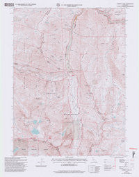
~ Caribou Lake CA topo map, 1:24000 scale, 7.5 X 7.5 Minute, Historical, 2001, updated 2004
Caribou Lake, California, USGS topographic map dated 2001.
Includes geographic coordinates (latitude and longitude). This topographic map is suitable for hiking, camping, and exploring, or framing it as a wall map.
Printed on-demand using high resolution imagery, on heavy weight and acid free paper, or alternatively on a variety of synthetic materials.
Topos available on paper, Waterproof, Poly, or Tyvek. Usually shipping rolled, unless combined with other folded maps in one order.
- Product Number: USGS-5510213
- Free digital map download (high-resolution, GeoPDF): Caribou Lake, California (file size: 14 MB)
- Map Size: please refer to the dimensions of the GeoPDF map above
- Weight (paper map): ca. 55 grams
- Map Type: POD USGS Topographic Map
- Map Series: HTMC
- Map Verison: Historical
- Cell ID: 7272
- Scan ID: 302620
- Imprint Year: 2004
- Aerial Photo Year: 1998
- Edit Year: 2001
- Datum: NAD27
- Map Projection: Lambert Conformal Conic
- Map published by United States Geological Survey
- Map published by United States Forest Service
- Map Language: English
- Scanner Resolution: 600 dpi
- Map Cell Name: Caribou Lake
- Grid size: 7.5 X 7.5 Minute
- Date on map: 2001
- Map Scale: 1:24000
- Geographical region: California, United States
Neighboring Maps:
All neighboring USGS topo maps are available for sale online at a variety of scales.
Spatial coverage:
Topo map Caribou Lake, California, covers the geographical area associated the following places:
- Le Roy Mine - Bullards Basin - Yellow Rose Mine - Big Conrad Gulch - Big Flat Campground - Red Rock Mountain - Crosby Gulch - Lower Nash Mine - Browns Gulch - Caribou Gulch - Gulick Mine - Upper Nash Mine - Moraine Lake - Adams Creek - Petrified Gulch - Caribou Lake - Emerald Lake - Lower Caribou Lake - Union Lake - Sawtooth Ridge - Packers Peak Cabin - Thompson Gulch - Landers Lake - Union Creek - Little Conrad Gulch - Caribou Mountain - Hickory Creek - Preachers Peak - Rocky Gulch - Black Mountain - Gulick Creek - North Fork Adams Creek - Browns Meadow - Hardscrabble Creek - Sunrise Creek - Mountain Meadow Ranch - Josephine Lake - Little Caribou Lake - French Cove - Adams Lake - Caribou Meadows - Lakeview Ranch - Grouse Ridge - Lower Nash Mine - Packers Gulch - Kidd Creek - Carter Cabin - Snowslide Peak - Dorleska Mine - Poorman Gulch - Blue Lady Spring - Abrams Cabin (historical) - Ward Lake - Big Flat - Snowslide Lake - Pin Creek - Packers Peak - Coyote Peak
- Map Area ID: AREA41.12541-123-122.875
- Northwest corner Lat/Long code: USGSNW41.125-123
- Northeast corner Lat/Long code: USGSNE41.125-122.875
- Southwest corner Lat/Long code: USGSSW41-123
- Southeast corner Lat/Long code: USGSSE41-122.875
- Northern map edge Latitude: 41.125
- Southern map edge Latitude: 41
- Western map edge Longitude: -123
- Eastern map edge Longitude: -122.875


