
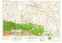
~ San Bernardino CA topo map, 1:250000 scale, 1 X 2 Degree, Historical, 1966, updated 1966
San Bernardino, California, USGS topographic map dated 1966.
Includes geographic coordinates (latitude and longitude). This topographic map is suitable for hiking, camping, and exploring, or framing it as a wall map.
Printed on-demand using high resolution imagery, on heavy weight and acid free paper, or alternatively on a variety of synthetic materials.
Topos available on paper, Waterproof, Poly, or Tyvek. Usually shipping rolled, unless combined with other folded maps in one order.
- Product Number: USGS-5506645
- Free digital map download (high-resolution, GeoPDF): San Bernardino, California (file size: 19 MB)
- Map Size: please refer to the dimensions of the GeoPDF map above
- Weight (paper map): ca. 55 grams
- Map Type: POD USGS Topographic Map
- Map Series: HTMC
- Map Verison: Historical
- Cell ID: 69012
- Scan ID: 299872
- Imprint Year: 1966
- Woodland Tint: Yes
- Field Check Year: 1958
- Datum: Unstated
- Map Projection: Transverse Mercator
- Map published by United States Army Corps of Engineers
- Map published by United States Army
- Map Language: English
- Scanner Resolution: 600 dpi
- Map Cell Name: San Bernardino
- Grid size: 1 X 2 Degree
- Date on map: 1966
- Map Scale: 1:250000
- Geographical region: California, United States
Neighboring Maps:
All neighboring USGS topo maps are available for sale online at a variety of scales.
Spatial coverage:
Topo map San Bernardino, California, covers the geographical area associated the following places:
- Yucaipa - Woodside Village - Industry - Ragtown - Joshua Tree - Lone Wolf Colony - Victorville - Butler - Rochester - Lake Los Angeles - Mound City (historical) - Stalder - Pinon Hills Estates - Cloverleaf Canyon - Highland - West Highlands - Country Mobile Estates - Arrowhead Highlands - Lugo - Juniper Hills - Crestmore - Adelanto - Minnelusa - Barstow Heights - Rana - Skyland - Irwin Estates - South Adelanto - Baldy Mesa - Champagne - Pearblossom - Desert Knolls - College Heights - Palm Wells - Calico - The Village - Rancho Cucamonga - Alray - Eads (historical) - Devore Heights - Oro Grande - North Shore - Lone Hill Manor Mobile Home Park - Bismarck (historical) - Pinto Wye - Orange Avenue Junction - Ormand - Pomona - Hi Vista - Agua Fria - The Pines (historical) - Arrowhead Springs - Ordway - Walnut Ridge - Piñon Hills - Kramer Hills (historical) - Bethune - Valinda - Crown Jewel - Harlem Springs - Redlands - Creekside - Yermo - Arrowhead - North Star Ranch - Valley of Enchantment - Fizzben Heights - Eniwetok Housing Area - Lake Arrowhead - Rich - Smiley Heights - Mariana Ranchos - Plymouth Village - Cajon - Manix - Mojave Heights - Wrightwood - Silver Lakes - Johnson Corner - North Norton - Poe (historical) - Landers - Citrus - Los Olivos - Valley High North - Wildhorse Canyon - Las Uvas (historical) - San Sevaine (historical) - Claremont - Browns (historical) - Mentone - Loma Linda - Apple Valley - Sierra Heights - Declez - Grand Terrace - Calimesa - Desert Heights - Cotners Corner - Desert View Housing Area
- Map Area ID: AREA3534-118-116
- Northwest corner Lat/Long code: USGSNW35-118
- Northeast corner Lat/Long code: USGSNE35-116
- Southwest corner Lat/Long code: USGSSW34-118
- Southeast corner Lat/Long code: USGSSE34-116
- Northern map edge Latitude: 35
- Southern map edge Latitude: 34
- Western map edge Longitude: -118
- Eastern map edge Longitude: -116


