
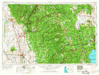
~ Chico CA topo map, 1:250000 scale, 1 X 2 Degree, Historical, 1958, updated 1967
Chico, California, USGS topographic map dated 1958.
Includes geographic coordinates (latitude and longitude). This topographic map is suitable for hiking, camping, and exploring, or framing it as a wall map.
Printed on-demand using high resolution imagery, on heavy weight and acid free paper, or alternatively on a variety of synthetic materials.
Topos available on paper, Waterproof, Poly, or Tyvek. Usually shipping rolled, unless combined with other folded maps in one order.
- Product Number: USGS-5506511
- Free digital map download (high-resolution, GeoPDF): Chico, California (file size: 22 MB)
- Map Size: please refer to the dimensions of the GeoPDF map above
- Weight (paper map): ca. 55 grams
- Map Type: POD USGS Topographic Map
- Map Series: HTMC
- Map Verison: Historical
- Cell ID: 72222
- Scan ID: 299746
- Imprint Year: 1967
- Woodland Tint: Yes
- Edit Year: 1966
- Field Check Year: 1958
- Datum: Unstated
- Map Projection: Transverse Mercator
- Map Language: English
- Scanner Resolution: 600 dpi
- Map Cell Name: Chico
- Grid size: 1 X 2 Degree
- Date on map: 1958
- Map Scale: 1:250000
- Geographical region: California, United States
Neighboring Maps:
All neighboring USGS topo maps are available for sale online at a variety of scales.
Spatial coverage:
Topo map Chico, California, covers the geographical area associated the following places:
- The Garden Mobile Home Park - Moseley (historical) - Flea Valley (historical) - Yuba (historical) - Rough and Ready - Condemned Bar (historical) - Ophir Hill Acres - Fraziers Landing - Cal-Ida - Maredith Mill - Quartz (historical) - Nord - Richland (historical) - Bihlman (historical) - Pipers (historical) - Prosser Lake Heights - Nevada City - Lira - Tahoma - Greenhorn - Leduc Acres - South Fork (historical) - Nelsons Crossing - Remington Hill (historical) - Emigrant Gap - Roble - Timberland - Barber - Glenridge Park - Hinsdale - Shady Glen - La Barr Meadows - Hallelujah Junction - Lake Davis - Penn Valley - Honcut - Quincy - Omega - Snow Tent (historical) - Malakoff (historical) - Graino - Colfax - Sunrise Heights - Blue Tent - Rampart - Talmont - Linda - Middle Waters (historical) - Oxford Mill - Olive Hill - Big Bar - Alta Sierra Estates - Secret Canyon (historical) - Palmetto - Gridley Colony Number One (historical) - Oroville - Kerby (historical) - Helltown - Michopdo (historical) - Thermalito - Pine Land - Meridian - Rawhide - Plumas Lake - Twin Pines - Grass Valley - Spring Hill - Poe - Plumbago - Merrimac - Snow Point (historical) - Evergreen Estates - Shands (historical) - Sicard Flat - DeSabla - Alta Hill - Forest Spring (historical) - Sierra Knoll Estates - Secret Town - Sunset - Spruce (historical) - Truckee - Milton (historical) - Eagle Bird (historical) - McMahons (historical) - Gilberts - Alpine Meadows - Junction House - Sebastopol - Bitney Corner - Monte Vista - Vinboy Trailer Park - Hume (historical) - Hughes Place - Elsey - Massack - Baltimore (historical) - Twin Peaks Estates - Plumas - Dodgeland
- Map Area ID: AREA4039-122-120
- Northwest corner Lat/Long code: USGSNW40-122
- Northeast corner Lat/Long code: USGSNE40-120
- Southwest corner Lat/Long code: USGSSW39-122
- Southeast corner Lat/Long code: USGSSE39-120
- Northern map edge Latitude: 40
- Southern map edge Latitude: 39
- Western map edge Longitude: -122
- Eastern map edge Longitude: -120


