
~ Chico CA topo map, 1:250000 scale, 1 X 2 Degree, Historical, 1958, updated 1962
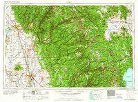
Chico, California, USGS topographic map dated 1958.
Includes geographic coordinates (latitude and longitude). This topographic map is suitable for hiking, camping, and exploring, or framing it as a wall map.
Printed on-demand using high resolution imagery, on heavy weight and acid free paper, or alternatively on a variety of synthetic materials.
Topos available on paper, Waterproof, Poly, or Tyvek. Usually shipping rolled, unless combined with other folded maps in one order.
- Product Number: USGS-5506509
- Free digital map download (high-resolution, GeoPDF): Chico, California (file size: 24 MB)
- Map Size: please refer to the dimensions of the GeoPDF map above
- Weight (paper map): ca. 55 grams
- Map Type: POD USGS Topographic Map
- Map Series: HTMC
- Map Verison: Historical
- Cell ID: 72222
- Scan ID: 299745
- Imprint Year: 1962
- Woodland Tint: Yes
- Field Check Year: 1958
- Datum: Unstated
- Map Projection: Transverse Mercator
- Map published by United States Army Corps of Engineers
- Map published by United States Army
- Map Language: English
- Scanner Resolution: 600 dpi
- Map Cell Name: Chico
- Grid size: 1 X 2 Degree
- Date on map: 1958
- Map Scale: 1:250000
- Geographical region: California, United States
Neighboring Maps:
All neighboring USGS topo maps are available for sale online at a variety of scales.
Spatial coverage:
Topo map Chico, California, covers the geographical area associated the following places:
- Anita - Gridley - Eskini (historical) - Ponderosa Fairway Estates - Frosts (historical) - Idlewild - White Spot - China Gulch (historical) - Blue Tent - Country Side Mobile Home Park - Alleghany - David (historical) - Gate Place - Yankee Jims - Brush Creek - Clio - Michopdo (historical) - Irish Town - Michigan Bluff - Enterprise (historical) - Forest Spring (historical) - Bitney Corner - Dentens (historical) - Rackerby - Massack - Ramada - Barber - Penn Valley - Thunderbird Mobile Home Park - Sunset - Stirling City - Lake Wildwood - Big Ripples (historical) - Tisdale - The Cedars - Campbell Hot Springs - Quincy Junction - American Hill (historical) - Forest Knolls - Oregon House - Bidwell Bar (historical) - Two Rivers - Hughes Mill - Nord - Maybert (historical) - Birchville - Mohawk Vista - Browns Valley - Ridgewood - Boca - Palmetto - Butte House (historical) - Nelsons Crossing - Starbright Acres - Cherokee - Randolph - Cedar Mill - Chandon (historical) - Ramirez - Pine Land - Norden - Omega - Condemned Bar (historical) - New York Flat (historical) - Snow Tent (historical) - Dantoni - Richardson Springs - Stanford (historical) - Bullards Bar (historical) - Aero Pines Mobile Home Park - Middle Waters (historical) - Secret Canyon (historical) - Bronco - Centerville - Walkermine (historical) - Sanders - French Corral - Sherwood Forest - Oak Grove (historical) - Oregon City - Timber Trails - Champion (historical) - Donner Woods - Stanfield Hill - Grizzly Gulch (historical) - Forebay - Oak Valley - Dillon (historical) - Heather Glen - Calvada (historical) - Mineral Slide - Wicks Corner - Dobbins - Gold Flat - Willow Valley - Emigrant Gap - Dodgeland - Tahoe Estates - Coombs (historical) - Calpine
- Map Area ID: AREA4039-122-120
- Northwest corner Lat/Long code: USGSNW40-122
- Northeast corner Lat/Long code: USGSNE40-120
- Southwest corner Lat/Long code: USGSSW39-122
- Southeast corner Lat/Long code: USGSSE39-120
- Northern map edge Latitude: 40
- Southern map edge Latitude: 39
- Western map edge Longitude: -122
- Eastern map edge Longitude: -120


