
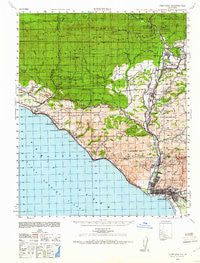
~ Ventura CA topo map, 1:62500 scale, 15 X 15 Minute, Historical, 1941, updated 1961
Ventura, California, USGS topographic map dated 1941.
Includes geographic coordinates (latitude and longitude). This topographic map is suitable for hiking, camping, and exploring, or framing it as a wall map.
Printed on-demand using high resolution imagery, on heavy weight and acid free paper, or alternatively on a variety of synthetic materials.
Topos available on paper, Waterproof, Poly, or Tyvek. Usually shipping rolled, unless combined with other folded maps in one order.
- Product Number: USGS-5504991
- Free digital map download (high-resolution, GeoPDF): Ventura, California (file size: 9 MB)
- Map Size: please refer to the dimensions of the GeoPDF map above
- Weight (paper map): ca. 55 grams
- Map Type: POD USGS Topographic Map
- Map Series: HTMC
- Map Verison: Historical
- Cell ID: 64069
- Scan ID: 301929
- Imprint Year: 1961
- Woodland Tint: Yes
- Aerial Photo Year: 1941
- Datum: NAD27
- Map Projection: Transverse Mercator
- Map published by United States Army
- Map Language: English
- Scanner Resolution: 600 dpi
- Map Cell Name: Ventura
- Grid size: 15 X 15 Minute
- Date on map: 1941
- Map Scale: 1:62500
- Geographical region: California, United States
Neighboring Maps:
All neighboring USGS topo maps are available for sale online at a variety of scales.
Spatial coverage:
Topo map Ventura, California, covers the geographical area associated the following places:
- Pierpont Bay - Dulah - Los Pitos (historical) - Vista de Santa Barbara Mobile Homes - Meiners Oaks - Ojala - Vickers Hot Springs - Weldons - La Conchita - Ortonville - Matilija - Arroyo Mobile Home Park - Foster Park - Sea Cliff - Golden Oaks Mobile Home Park - Shepards - Golden Oaks Mobile Estates - Miscanaka (historical) - Mira Monte - Meiners Oaks Trailer Park - Live Oak Acres - Casitas Springs - Del Francia Mobile Estates - El Sereno Estates Mobile Home Park - Kimballville (historical) - Mussel Shoals - Matilija Springs - Oak View - Casitas Mobile Home Park - Arbolada - Rincon - Faria - Chrisman - Ojai Valley Estates Mobile Home Park - Wadstrom - Ventura
- Map Area ID: AREA34.534.25-119.5-119.25
- Northwest corner Lat/Long code: USGSNW34.5-119.5
- Northeast corner Lat/Long code: USGSNE34.5-119.25
- Southwest corner Lat/Long code: USGSSW34.25-119.5
- Southeast corner Lat/Long code: USGSSE34.25-119.25
- Northern map edge Latitude: 34.5
- Southern map edge Latitude: 34.25
- Western map edge Longitude: -119.5
- Eastern map edge Longitude: -119.25


