
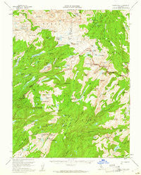
~ Tower Peak CA topo map, 1:62500 scale, 15 X 15 Minute, Historical, 1956, updated 1961
Tower Peak, California, USGS topographic map dated 1956.
Includes geographic coordinates (latitude and longitude). This topographic map is suitable for hiking, camping, and exploring, or framing it as a wall map.
Printed on-demand using high resolution imagery, on heavy weight and acid free paper, or alternatively on a variety of synthetic materials.
Topos available on paper, Waterproof, Poly, or Tyvek. Usually shipping rolled, unless combined with other folded maps in one order.
- Product Number: USGS-5504815
- Free digital map download (high-resolution, GeoPDF): Tower Peak, California (file size: 10 MB)
- Map Size: please refer to the dimensions of the GeoPDF map above
- Weight (paper map): ca. 55 grams
- Map Type: POD USGS Topographic Map
- Map Series: HTMC
- Map Verison: Historical
- Cell ID: 63653
- Scan ID: 301841
- Imprint Year: 1961
- Woodland Tint: Yes
- Aerial Photo Year: 1955
- Field Check Year: 1956
- Datum: NAD27
- Map Projection: Polyconic
- Map published by United States Geological Survey
- Map Language: English
- Scanner Resolution: 600 dpi
- Map Cell Name: Tower Peak
- Grid size: 15 X 15 Minute
- Date on map: 1956
- Map Scale: 1:62500
- Geographical region: California, United States
Neighboring Maps:
All neighboring USGS topo maps are available for sale online at a variety of scales.
Spatial coverage:
Topo map Tower Peak, California, covers the geographical area associated the following places:
- Tiltill Mountain - Mosquito Lake - Lake Vernon - Branigan Lake - Huckleberry Lake - Avonelle Lake - Maxwell Lake - Sachse Monument - Buck Lake - Kennedy Canyon - Emigrant Meadow - Lunch Meadow - Tilden Creek - Lertora Lake - Brown Bear Pass - Long Lake Dam - Emigrant Meadow Lake - Michie Peak - Lake Helen - Olive Lake - Otter Lake - Molo Mountain - Kendrick Peak - Fawn Lake - Blackbird Lake - Cinko Lake - Bearup Lake - Thompson Canyon - Moraine Ridge - Walker Meadows - Ehrnbeck Peak - Lower Long Lake - Little Otter Lake - Cascade Falls - Mahan Lake - Tilden Lake - Tower Peak - Frog Lake - Snow Peak - Lake Harriet - Wells Peak - Middle Emigrant Dam - Saucer Meadow - Lake Ruth - Tilden Canyon - Stubblefield Canyon - Jack Main Canyon - Fisher Lakes - Piute Mountain - Emigrant Pass - High Emigrant Lake 1-027 Dam - Wheeler Peak - Summit Meadow - Granite Dome - Andrews Lake - Kerrick Canyon - Buck Lake - Bailey Ridge - Acker Peak - Grace Meadow - Shallow Lake - W Lake - Macomb Ridge - Grizzly Peak - Buck Lake Dam - Tilden Canyon Creek - Emigrant Lake - Forsyth Peak - Emigrant Lake - Murdock Lake - Snowlake Dam - Upper Long Lake - Piute Cabin - Lower Piute Meadows - Black Hawk Lake - Cascade Creek - Tower Lake - Horse Meadow - Bigelow Lake - Kirkwood Lake - Piute Pass - Richardson Peak - Andrews Peak - Horse Meadow Reservoir - Mahan Peak - Hawksbeak Peak - Grizzly Lake - Peninsula Lake - Beartrap Lake - Long Canyon - Saurian Crest - Seavey Pass - Stella Lake - Lewis Lakes - Middle Emigrant Lake - Fraser Lakes - Haystack Peak - Sheep Camp - Benson Lake - Cow Meadow Lake
- Map Area ID: AREA38.2538-119.75-119.5
- Northwest corner Lat/Long code: USGSNW38.25-119.75
- Northeast corner Lat/Long code: USGSNE38.25-119.5
- Southwest corner Lat/Long code: USGSSW38-119.75
- Southeast corner Lat/Long code: USGSSE38-119.5
- Northern map edge Latitude: 38.25
- Southern map edge Latitude: 38
- Western map edge Longitude: -119.75
- Eastern map edge Longitude: -119.5


