
~ Tepusquet Peak CA topo map, 1:62500 scale, 15 X 15 Minute, Historical, 1942, updated 1966
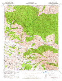
Tepusquet Peak, California, USGS topographic map dated 1942.
Includes geographic coordinates (latitude and longitude). This topographic map is suitable for hiking, camping, and exploring, or framing it as a wall map.
Printed on-demand using high resolution imagery, on heavy weight and acid free paper, or alternatively on a variety of synthetic materials.
Topos available on paper, Waterproof, Poly, or Tyvek. Usually shipping rolled, unless combined with other folded maps in one order.
- Product Number: USGS-5504753
- Free digital map download (high-resolution, GeoPDF): Tepusquet Peak, California (file size: 10 MB)
- Map Size: please refer to the dimensions of the GeoPDF map above
- Weight (paper map): ca. 55 grams
- Map Type: POD USGS Topographic Map
- Map Series: HTMC
- Map Verison: Historical
- Cell ID: 63455
- Scan ID: 301814
- Imprint Year: 1966
- Woodland Tint: Yes
- Aerial Photo Year: 1942
- Datum: NAD27
- Map Projection: Polyconic
- Map published by United States Army Corps of Engineers
- Map published by United States Department of War
- Map Language: English
- Scanner Resolution: 600 dpi
- Map Cell Name: Tepusquet Peak
- Grid size: 15 X 15 Minute
- Date on map: 1942
- Map Scale: 1:62500
- Geographical region: California, United States
Neighboring Maps:
All neighboring USGS topo maps are available for sale online at a variety of scales.
Spatial coverage:
Topo map Tepusquet Peak, California, covers the geographical area associated the following places:
- Kelly Canyon - Roque Canyon - Hudson Canyon - Cigarette Spring - Colson Canyon - Zaca Lake - Owl Canyon - Lion Canyon - Ballard Campground - Pickett Corral - Kerry Canyon Campground - Alejandro Canyon - Diamond-T Ranch - Bear Campsite - Colson Canyon Campgrounds - Colson Summit Quarry - La Zaca - Rattlesnake Canyon - Alejandro Campground - Horse Canyon - Round Corral - Colson Canyon Campgrounds - Kerry Canyon - KXFM-FM (Santa Maria) - Fremont-Foxen Monument - Barrel Springs Recreation Site - South Fork La Brea Creek - Jesse Campground - Ruiz Canyon - Bee Rock - Cañada del Agua Amarga - Roque Campground - Salsipuedes Canyon - Tunnel Canyon - Tinaquaic - Honeymoon Flat - Sisquoc - Foxen Adobe - Sulphur Spring - Bee Rock Canyon - Horseshoe Springs Recreation - Barrel Springs - La Jolla Spring - Peach Tree Spring - Alkali Canyon - Lazy Campground - Ramrod Canyon - Goodchild Ranch - Lion Canyon - Difficult Spring - Lookout Mountain - Rattlesnake Canyon - Buckhorn Ridge - Liebe Canyon - Canovos Canyon - Schoolhouse Canyon - Bone Mountain - Gato Ridge - Foxen Canyon - Hunter Spring - Chuchudas Campground - La Laguna - Zaca Peak - Rattlesnake Canyon - Whoop Canyon - Foxen Canyon Cemetery - Oak Valley Creek - Zaca Ridge - Jesus Canyon - Manzanita Mountain - Asphaltum Mine - Script Canyon Number One - Bear Canyon - Rancho Tinaquaic - Cherokee Spring - Tunnel Spring - Flores Canyon - Sluice Box Campground - Suey Canyon - La Brea Creek - Asphaltum Creek - KCOY-TV (Santa Maria) - Horseshoe Spring - Alejandro Campground - Gato Ridge Oil Field - Tyler Canyon - North Fork La Brea Creek - Stag Canyon - Tepusquet Peak - Adams Ranch - Hiawatha Campground - Cañada Arena - Script Canyon Number Two - White Elephant Mine - Wildhorse Canyon - Bell Canyon - Tunnel Ranch - Sulphur Creek - Cuchudas Canyon - Ballard Campground
- Map Area ID: AREA3534.75-120.25-120
- Northwest corner Lat/Long code: USGSNW35-120.25
- Northeast corner Lat/Long code: USGSNE35-120
- Southwest corner Lat/Long code: USGSSW34.75-120.25
- Southeast corner Lat/Long code: USGSSE34.75-120
- Northern map edge Latitude: 35
- Southern map edge Latitude: 34.75
- Western map edge Longitude: -120.25
- Eastern map edge Longitude: -120


