
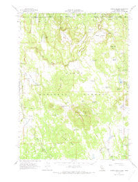
~ Steele Swamp CA topo map, 1:62500 scale, 15 X 15 Minute, Historical, 1962, updated 1973
Steele Swamp, California, USGS topographic map dated 1962.
Includes geographic coordinates (latitude and longitude). This topographic map is suitable for hiking, camping, and exploring, or framing it as a wall map.
Printed on-demand using high resolution imagery, on heavy weight and acid free paper, or alternatively on a variety of synthetic materials.
Topos available on paper, Waterproof, Poly, or Tyvek. Usually shipping rolled, unless combined with other folded maps in one order.
- Product Number: USGS-5504623
- Free digital map download (high-resolution, GeoPDF): Steele Swamp, California (file size: 6 MB)
- Map Size: please refer to the dimensions of the GeoPDF map above
- Weight (paper map): ca. 55 grams
- Map Type: POD USGS Topographic Map
- Map Series: HTMC
- Map Verison: Historical
- Cell ID: 62950
- Scan ID: 301756
- Imprint Year: 1973
- Woodland Tint: Yes
- Aerial Photo Year: 1958
- Field Check Year: 1962
- Datum: NAD27
- Map Projection: Polyconic
- Map published by United States Geological Survey
- Map Language: English
- Scanner Resolution: 600 dpi
- Map Cell Name: Steele Swamp
- Grid size: 15 X 15 Minute
- Date on map: 1962
- Map Scale: 1:62500
- Geographical region: California, United States
Neighboring Maps:
All neighboring USGS topo maps are available for sale online at a variety of scales.
Spatial coverage:
Topo map Steele Swamp, California, covers the geographical area associated the following places:
- Boles Tank - Huffman Butte - Crowder Flat Station - Wild Horse Reservoir - Blue Mountain Spring - Tramp Spring - Blue Mountain Meadows Tank - Timbered Ridge Reservoir - Kellogg Mountain - State Line Guard Station (historical) - Buckhorn Spring - Hager Ranch - Garden Tank - East Point - A and C 1110-002 Dam - Picnic Grove Reservoir - Dip Spring - Pothole Spring - Crowder Flat Ranger Station - Juniper Spring - Avanzino Ranch - Warm Spring - Quaking Aspen Spring - Weed Valley - Hager Basin - Janes Flat 121 Dam - Steele Swamp Ranch - Coyote Meadow - Fourmile Creek - Hager Basin Reservoir - Huffman Butte Tank - Hidden Valley - Wild Horse Valley - Avanzino Reservoir - Beaver Creek - Fourmile Reservoir - Wilcox Spring - Grohs Ranch - Dry Valley Reservoir - Triple Spring - Pothole Valley - Janes Reservoir - Crowder Flat Station - Buchanan Flat - Steele Swamp - Rock Creek Reservoir - Fort Spring - Kellogg Tank - Wild Horse Creek - Bird Spring - Bird Spring Ridge - Willow Creek - Diamond Reservoir - Blue Mountain - Fourmile Valley - Jims Flat - Timbered Ridge - Baseball Reservoir - Weed Valley Ranch - Boles Spring - Rock Creek
- Map Area ID: AREA4241.75-121-120.75
- Northwest corner Lat/Long code: USGSNW42-121
- Northeast corner Lat/Long code: USGSNE42-120.75
- Southwest corner Lat/Long code: USGSSW41.75-121
- Southeast corner Lat/Long code: USGSSE41.75-120.75
- Northern map edge Latitude: 42
- Southern map edge Latitude: 41.75
- Western map edge Longitude: -121
- Eastern map edge Longitude: -120.75


