
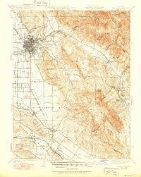
~ Santa Rosa CA topo map, 1:62500 scale, 15 X 15 Minute, Historical, 1944, updated 1951
Santa Rosa, California, USGS topographic map dated 1944.
Includes geographic coordinates (latitude and longitude). This topographic map is suitable for hiking, camping, and exploring, or framing it as a wall map.
Printed on-demand using high resolution imagery, on heavy weight and acid free paper, or alternatively on a variety of synthetic materials.
Topos available on paper, Waterproof, Poly, or Tyvek. Usually shipping rolled, unless combined with other folded maps in one order.
- Product Number: USGS-5504361
- Free digital map download (high-resolution, GeoPDF): Santa Rosa, California (file size: 10 MB)
- Map Size: please refer to the dimensions of the GeoPDF map above
- Weight (paper map): ca. 55 grams
- Map Type: POD USGS Topographic Map
- Map Series: HTMC
- Map Verison: Historical
- Cell ID: 62137
- Scan ID: 301628
- Imprint Year: 1951
- Edit Year: 1942
- Survey Year: 1914
- Datum: NAD
- Map Projection: Polyconic
- Map published by United States Geological Survey
- Map published by United States Army Corps of Engineers
- Map Language: English
- Scanner Resolution: 600 dpi
- Map Cell Name: Santa Rosa
- Grid size: 15 X 15 Minute
- Date on map: 1944
- Map Scale: 1:62500
- Geographical region: California, United States
Neighboring Maps:
All neighboring USGS topo maps are available for sale online at a variety of scales.
Spatial coverage:
Topo map Santa Rosa, California, covers the geographical area associated the following places:
- Washoe - Ely (historical) - Corona (historical) - Los Guilicos - Felice (historical) - Lawndale - Roseland - Melita - Larkfield - Wildwood (historical) - Rohnert Park - Bak - Diamond A Ranch Estates - Crown - Penngrove - Stony Point - South Santa Rosa - Waldrue Heights - Cherry (historical) - Beltaine (historical) - Denman (historical) - Wilfred - Cotati - Oakmont - Sonoma Vista - Kenwood - Madrone (historical) - Leisure Lake Mobile Home Park - Yulupa (historical) - Glen Ellen - Bellevue - Liberty - Montgomery Village - Santa Rosa - Eldridge
- Map Area ID: AREA38.538.25-122.75-122.5
- Northwest corner Lat/Long code: USGSNW38.5-122.75
- Northeast corner Lat/Long code: USGSNE38.5-122.5
- Southwest corner Lat/Long code: USGSSW38.25-122.75
- Southeast corner Lat/Long code: USGSSE38.25-122.5
- Northern map edge Latitude: 38.5
- Southern map edge Latitude: 38.25
- Western map edge Longitude: -122.75
- Eastern map edge Longitude: -122.5


