
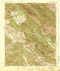
~ Priest Valley CA topo map, 1:62500 scale, 15 X 15 Minute, Historical, 1944
Priest Valley, California, USGS topographic map dated 1944.
Includes geographic coordinates (latitude and longitude). This topographic map is suitable for hiking, camping, and exploring, or framing it as a wall map.
Printed on-demand using high resolution imagery, on heavy weight and acid free paper, or alternatively on a variety of synthetic materials.
Topos available on paper, Waterproof, Poly, or Tyvek. Usually shipping rolled, unless combined with other folded maps in one order.
- Product Number: USGS-5503821
- Free digital map download (high-resolution, GeoPDF): Priest Valley, California (file size: 13 MB)
- Map Size: please refer to the dimensions of the GeoPDF map above
- Weight (paper map): ca. 55 grams
- Map Type: POD USGS Topographic Map
- Map Series: HTMC
- Map Verison: Historical
- Cell ID: 61308
- Scan ID: 298679
- Woodland Tint: Yes
- Survey Year: 1941
- Datum: NAD27
- Map Projection: Polyconic
- Map published by United States Geological Survey
- Map published by United States Department of War
- Map Language: English
- Scanner Resolution: 600 dpi
- Map Cell Name: Priest Valley
- Grid size: 15 X 15 Minute
- Date on map: 1944
- Map Scale: 1:62500
- Geographical region: California, United States
Neighboring Maps:
All neighboring USGS topo maps are available for sale online at a variety of scales.
Spatial coverage:
Topo map Priest Valley, California, covers the geographical area associated the following places:
- Hot Springs Canyon - Blue Canyon - Frames Peak - Twin Peaks - Sunk Canyon - Splitrock Spring - Barberry Spring - West Spring - Stone Canyon Mine - Alum Creek - Stone Canyon - Sheehee Spring - Powell Spring - Charley Valley - Hollyhock Spring - Woll School (historical) - Live Oak Spring - Buckeye Spring - Stove Canyon - Hidden Valley - Bourdieu Valley - Roberts Canyon - Flag Peak - Mulch Canyon - Eagle Rock - Charley Creek - Pretty Flat - Skeleton Spring - Splitrock Canyon - Sulphur Creek - Juniper Ridge - Echo Canyon - Eric Spring - Eblen Spring - Bald Mountain - The Pinnacles - Barr Spring - Charley Mountain - Bear Trap Spring - McMillan Spring - Tule Spring - Hewitt Valley - The Gorge - Pine Canyon - Elliot Spring - Little Oak Flat - Easton Spring - Stove Ridge - Bear Gulch - Squaw Peak - Grabast Canyon - Buckeye Spring - Gravelly Flat - Clayton Cemetery - Log Cabin Spring - Los Gatos Creek County Park - Salt Canyon - Bear Canyon - Slack Canyon - Sawmill Canyon - Hog Canyon - Studhorse Canyon - Andrews Peak - Nelson Creek - Coalinga Mineral Spring - Slack Canyon Conservation Camp - Freitas Spring - Wayland Creek - Devils Gate - Williams-Duckworth Cemetery - Iron Spring - Dutchman Canyon - Bee Canyon - Rambo Spring - Moonshine Spring - Rock House Spring - Rude Spring - Coalinga Mineral Springs - Priest Valley School - Little Bear Canyon - Brock Springs - Goat Mountain - Quesada Spring - Indian Spring - Monroe Lake - Bear Spring - Little Bitterwater Spring - Smith Mountain - Stove Spring - Sulphur Spring - Little Bitterwater Canyon - Monroe Valley - Willow Spring - Mud Run - Jack Hart Spring - Round Mountain - Priest Valley - Lewis Canyon - Live Oak Spring - Dogwood Canyon
- Map Area ID: AREA36.2536-120.75-120.5
- Northwest corner Lat/Long code: USGSNW36.25-120.75
- Northeast corner Lat/Long code: USGSNE36.25-120.5
- Southwest corner Lat/Long code: USGSSW36-120.75
- Southeast corner Lat/Long code: USGSSE36-120.5
- Northern map edge Latitude: 36.25
- Southern map edge Latitude: 36
- Western map edge Longitude: -120.75
- Eastern map edge Longitude: -120.5


