
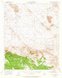
~ Old Woman Springs CA topo map, 1:62500 scale, 15 X 15 Minute, Historical, 1955, updated 1966
Old Woman Springs, California, USGS topographic map dated 1955.
Includes geographic coordinates (latitude and longitude). This topographic map is suitable for hiking, camping, and exploring, or framing it as a wall map.
Printed on-demand using high resolution imagery, on heavy weight and acid free paper, or alternatively on a variety of synthetic materials.
Topos available on paper, Waterproof, Poly, or Tyvek. Usually shipping rolled, unless combined with other folded maps in one order.
- Product Number: USGS-5503355
- Free digital map download (high-resolution, GeoPDF): Old Woman Springs, California (file size: 7 MB)
- Map Size: please refer to the dimensions of the GeoPDF map above
- Weight (paper map): ca. 55 grams
- Map Type: POD USGS Topographic Map
- Map Series: HTMC
- Map Verison: Historical
- Cell ID: 60509
- Scan ID: 298394
- Imprint Year: 1966
- Woodland Tint: Yes
- Aerial Photo Year: 1952
- Field Check Year: 1955
- Datum: NAD27
- Map Projection: Polyconic
- Map published by United States Geological Survey
- Map Language: English
- Scanner Resolution: 600 dpi
- Map Cell Name: Old Woman Springs
- Grid size: 15 X 15 Minute
- Date on map: 1955
- Map Scale: 1:62500
- Geographical region: California, United States
Neighboring Maps:
All neighboring USGS topo maps are available for sale online at a variety of scales.
Spatial coverage:
Topo map Old Woman Springs, California, covers the geographical area associated the following places:
- Vaughn Spring - Rock Corral - Means Lake - Viscera Spring - Kelly Airport - Shehorn Ranch - San Bernardino County Fire Department Station 43 Johnson - Upper Johnson Valley - Bighorn Mountain Wilderness - Abraham Ranch Airport - Rattlesnake Spring - Fry Valley - B & E Ranch Airport - Champion Joshua Tree - Granite Peaks - Melville Lake - Arrastre Creek - Bighorn Mountains - Parson Ranch - Two Hole Spring - Rubber Drain Two - Mound Spring - Johnson Valley - Bighorn Canyon - Old Woman Springs - Soggy Lake - Old Woman Spring Ranch - Tip Top Mountain - One Hole Spring - Saddlerock Spring - Means Well - Green Rock Mine - Rattlesnake Canyon - Cottonwood Spring - Lafon Ranch - Valley Vista Airport
- Map Area ID: AREA34.534.25-116.75-116.5
- Northwest corner Lat/Long code: USGSNW34.5-116.75
- Northeast corner Lat/Long code: USGSNE34.5-116.5
- Southwest corner Lat/Long code: USGSSW34.25-116.75
- Southeast corner Lat/Long code: USGSSE34.25-116.5
- Northern map edge Latitude: 34.5
- Southern map edge Latitude: 34.25
- Western map edge Longitude: -116.75
- Eastern map edge Longitude: -116.5


