
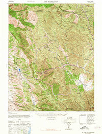
~ Mt Hamilton CA topo map, 1:62500 scale, 15 X 15 Minute, Historical, 1967, updated 1967
Mt Hamilton, California, USGS topographic map dated 1967.
Includes geographic coordinates (latitude and longitude). This topographic map is suitable for hiking, camping, and exploring, or framing it as a wall map.
Printed on-demand using high resolution imagery, on heavy weight and acid free paper, or alternatively on a variety of synthetic materials.
Topos available on paper, Waterproof, Poly, or Tyvek. Usually shipping rolled, unless combined with other folded maps in one order.
- Product Number: USGS-5503193
- Free digital map download (high-resolution, GeoPDF): Mt Hamilton, California (file size: 13 MB)
- Map Size: please refer to the dimensions of the GeoPDF map above
- Weight (paper map): ca. 55 grams
- Map Type: POD USGS Topographic Map
- Map Series: HTMC
- Map Verison: Historical
- Cell ID: 57988
- Scan ID: 298304
- Imprint Year: 1967
- Woodland Tint: Yes
- Aerial Photo Year: 1938
- Datum: NAD27
- Map Projection: Transverse Mercator
- Map published by United States Army
- Map Language: English
- Scanner Resolution: 600 dpi
- Map Cell Name: Mount Hamilton
- Grid size: 15 X 15 Minute
- Date on map: 1967
- Map Scale: 1:62500
- Geographical region: California, United States
Neighboring Maps:
All neighboring USGS topo maps are available for sale online at a variety of scales.
Spatial coverage:
Topo map Mt Hamilton, California, covers the geographical area associated the following places:
- Panochita Hill - Mount Hamilton - Van Horn Flats - The Narrows - Martys Ranch - Banta Spring - Parman Ranch - Colorado Camp - Mount Lewis - Divide Springs - Hamilton Flat - Tarraville Canyon - South Pocket - Hoodoo Gulch - Mount Hamilton Springs - Copernicus Peak - Chaboya Middle School - Halls Valley Lake - Pulse Canyon - Silver Creek Valley Country Club - Jays Ridge - Joseph D Grant County Park - Old Camp - Mesa Ridge - Sycamore Creek - San Felipe Hills - Jumpoff Creek - Jack Canyon - Bollinger Ridge - Isabel Creek - Bonita Creek - Arroyo Bayo - Bollinger Mountain - Mount Helen - Camp Ohlone Regional Park - Copernicus Peak Lookout Tower - Highland School - Cañada De Pala - Valpe Creek - Ruff Ranch (historical) - Isabel Valley - Indian Springs - San Felipe Ranch 1621 Dam - Sulphur Spring Gulch - Evergreen Valley High School - Scott Ranch - Crossley Reflector - Grizzly Flats - Carolyn A Clark Elementary School - Sulphur Creek - Masters Hill - Grant Company Number 2 1057-002 Dam - Sawtooth Canyon - Beartrap Ridge - Cow Creek - Castle Canyon - Castle Ridge - Ogier Ranch - Sugarloaf Mountain - Mount Day - Spring Canyon - Halls Valley School (historical) - Sulphur Gulch - Brush Mountain - Deadman Gulch - Long Gulch - Sams Canyon - Blumbago Canyon - Packard Ridge - Lamb Ridge - Baby Peak - Kuhn 624 Dam - Pino Creek - Camp Bessie - Long Branch - Hog Slough - Trail Canyon - Evergreen Ranch - Wiel Ranch (historical) - Bear Gulch - Ingram Flat - Tom Matsumoto Elementary School - Seeboy Ridge - Hays Camp - Eylar Mountain - Coe Ranch - New Camp - McGlinchey Spring - Los Huecos - Richmond Ranch - Soup Bowl Creek - Pyramid Rock - Colorado Creek - Smith Creek Ranger Station - Rancho Arroyo Bayo (historical) - San Antonio Creek - Lost Canyon - Lion Canyon - Turner Gulch - San Felipe Valley
- Map Area ID: AREA37.537.25-121.75-121.5
- Northwest corner Lat/Long code: USGSNW37.5-121.75
- Northeast corner Lat/Long code: USGSNE37.5-121.5
- Southwest corner Lat/Long code: USGSSW37.25-121.75
- Southeast corner Lat/Long code: USGSSE37.25-121.5
- Northern map edge Latitude: 37.5
- Southern map edge Latitude: 37.25
- Western map edge Longitude: -121.75
- Eastern map edge Longitude: -121.5


