
~ Mountain Springs Canyon CA topo map, 1:62500 scale, 15 X 15 Minute, Historical, 1953, updated 1963
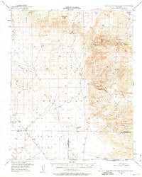
Mountain Springs Canyon, California, USGS topographic map dated 1953.
Includes geographic coordinates (latitude and longitude). This topographic map is suitable for hiking, camping, and exploring, or framing it as a wall map.
Printed on-demand using high resolution imagery, on heavy weight and acid free paper, or alternatively on a variety of synthetic materials.
Topos available on paper, Waterproof, Poly, or Tyvek. Usually shipping rolled, unless combined with other folded maps in one order.
- Product Number: USGS-5503131
- Free digital map download (high-resolution, GeoPDF): Mountain Springs Canyon, California (file size: 7 MB)
- Map Size: please refer to the dimensions of the GeoPDF map above
- Weight (paper map): ca. 55 grams
- Map Type: POD USGS Topographic Map
- Map Series: HTMC
- Map Verison: Historical
- Cell ID: 58156
- Scan ID: 298263
- Imprint Year: 1963
- Aerial Photo Year: 1948
- Survey Year: 1953
- Datum: NAD27
- Map Projection: Polyconic
- Map published by United States Geological Survey
- Map Language: English
- Scanner Resolution: 600 dpi
- Map Cell Name: Mountain Springs Canyon
- Grid size: 15 X 15 Minute
- Date on map: 1953
- Map Scale: 1:62500
- Geographical region: California, United States
Neighboring Maps:
All neighboring USGS topo maps are available for sale online at a variety of scales.
Spatial coverage:
Topo map Mountain Springs Canyon, California, covers the geographical area associated the following places:
- Black Canyon - Little Petroglyphs - Airport Lake - White Hills - Coso Basin - Mammoth Mine - Coso Rock Art District - Mountain Springs Canyon - Petroglyph Canyon - Sweetwater Wash - Deadman Canyon - Volcano Butte - Burro Canyon Test Facility - Sterling Queen Mine - Mountain Spring - Renegade Canyon - China Lake Naval Weapons Center - Burro Canyon - Paxton Ranch - Star of the West Mine - Dry Lakes - Wilson Canyon
- Map Area ID: AREA3635.75-117.75-117.5
- Northwest corner Lat/Long code: USGSNW36-117.75
- Northeast corner Lat/Long code: USGSNE36-117.5
- Southwest corner Lat/Long code: USGSSW35.75-117.75
- Southeast corner Lat/Long code: USGSSE35.75-117.5
- Northern map edge Latitude: 36
- Southern map edge Latitude: 35.75
- Western map edge Longitude: -117.75
- Eastern map edge Longitude: -117.5


