
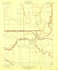
~ Union Island CA topo map, 1:31680 scale, 7.5 X 7.5 Minute, Historical, 1914
Union Island, California, USGS topographic map dated 1914.
Includes geographic coordinates (latitude and longitude). This topographic map is suitable for hiking, camping, and exploring, or framing it as a wall map.
Printed on-demand using high resolution imagery, on heavy weight and acid free paper, or alternatively on a variety of synthetic materials.
Topos available on paper, Waterproof, Poly, or Tyvek. Usually shipping rolled, unless combined with other folded maps in one order.
- Product Number: USGS-5500137
- Free digital map download (high-resolution, GeoPDF): Union Island, California (file size: 5 MB)
- Map Size: please refer to the dimensions of the GeoPDF map above
- Weight (paper map): ca. 55 grams
- Map Type: POD USGS Topographic Map
- Map Series: HTMC
- Map Verison: Historical
- Cell ID: 46347
- Scan ID: 296577
- Survey Year: 1912
- Datum: Unstated
- Map Projection: Unstated
- Map published by United States Geological Survey
- Map Language: English
- Scanner Resolution: 600 dpi
- Map Cell Name: Union Island
- Grid size: 7.5 X 7.5 Minute
- Date on map: 1914
- Map Scale: 1:31680
- Geographical region: California, United States
Neighboring Maps:
All neighboring USGS topo maps are available for sale online at a variety of scales.
Spatial coverage:
Topo map Union Island, California, covers the geographical area associated the following places:
- Crossroads Christian Church - The Church of Jesus Christ of Latter Day Saints - California Highway Patrol Valley Division - Tracy - Church of Christ - Melville S Jacobson Elementary School - El Pescadero Park - Tracy Fire Department Station 96 - Tracy Police Department Substation - Union Island - Slayter Park - El Pescadero - Duncan-Russell Continuation High School - Union Island Gas Field - Fabian and Bell Canal - Grant Line Canal - Ornellas Dairy - Tracy Bible Fellowship Church - Kenner Park - Salmon Slough - Larch Clover Park - McKinley Village Shopping Center - Amazing Grace Church True Tabernacle of God - Moreda Valley Dairy Number 4 - Naglee School (historical) - Delta Island Elementary School - Sugar Cut - North Elementary School - Tracy Police Department Substation - Family Bible Church - Tracy Seventh Day Adventist Church - Valley Shopping Center - Tracy Ball Park - Tom Paine Slough - Tracy Shopping Center - Lower Main Canal - Trinity Baptist Church - Undine School (historical)
- Map Area ID: AREA37.87537.75-121.5-121.375
- Northwest corner Lat/Long code: USGSNW37.875-121.5
- Northeast corner Lat/Long code: USGSNE37.875-121.375
- Southwest corner Lat/Long code: USGSSW37.75-121.5
- Southeast corner Lat/Long code: USGSSE37.75-121.375
- Northern map edge Latitude: 37.875
- Southern map edge Latitude: 37.75
- Western map edge Longitude: -121.5
- Eastern map edge Longitude: -121.375


