
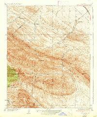
~ Reef Ridge CA topo map, 1:31680 scale, 7.5 X 7.5 Minute, Historical, 1937
Reef Ridge, California, USGS topographic map dated 1937.
Includes geographic coordinates (latitude and longitude). This topographic map is suitable for hiking, camping, and exploring, or framing it as a wall map.
Printed on-demand using high resolution imagery, on heavy weight and acid free paper, or alternatively on a variety of synthetic materials.
Topos available on paper, Waterproof, Poly, or Tyvek. Usually shipping rolled, unless combined with other folded maps in one order.
- Product Number: USGS-5499893
- Free digital map download (high-resolution, GeoPDF): Reef Ridge, California (file size: 11 MB)
- Map Size: please refer to the dimensions of the GeoPDF map above
- Weight (paper map): ca. 55 grams
- Map Type: POD USGS Topographic Map
- Map Series: HTMC
- Map Verison: Historical
- Cell ID: 16927
- Scan ID: 296452
- Woodland Tint: Yes
- Survey Year: 1934
- Datum: NAD
- Map Projection: Polyconic
- Map published by United States Geological Survey
- Map Language: English
- Scanner Resolution: 600 dpi
- Map Cell Name: Garza Peak
- Grid size: 7.5 X 7.5 Minute
- Date on map: 1937
- Map Scale: 1:31680
- Geographical region: California, United States
Neighboring Maps:
All neighboring USGS topo maps are available for sale online at a variety of scales.
Spatial coverage:
Topo map Reef Ridge, California, covers the geographical area associated the following places:
- Dirty Spring - Sulphur Spring Canyon - The Turtle Hole - Big Tar Canyon - Falls Canyon - Dawson Mine - Tiger Spring - Chalk Buttes - Garza Peak - Tar Peak - Willow Spring Canyon - Ragged Top - Boy Scout Camp - Flattop - Segaser Ranch - Rhodes Cabin (historical) - Roundtop - Double Spring - Wade Baxter Spring - Poison Oak Canyon - Jones Ranch (historical) - Sulphur Spring - Hay Flat - Zwang Peak - Willow Spring - Bullpen Canyon - Tiger Spring - Avenal Canyon Mine - Baby King Canyon - Clark Ranch - Roof Spring - Willow Spring - Baby King Creek - Kreyenhagen Ranch
- Map Area ID: AREA3635.875-120.25-120.125
- Northwest corner Lat/Long code: USGSNW36-120.25
- Northeast corner Lat/Long code: USGSNE36-120.125
- Southwest corner Lat/Long code: USGSSW35.875-120.25
- Southeast corner Lat/Long code: USGSSE35.875-120.125
- Northern map edge Latitude: 36
- Southern map edge Latitude: 35.875
- Western map edge Longitude: -120.25
- Eastern map edge Longitude: -120.125


