
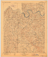
~ Stonewall OK topo map, 1:125000 scale, 30 X 30 Minute, Historical, 1901, updated 1928
Stonewall, Oklahoma, USGS topographic map dated 1901.
Includes geographic coordinates (latitude and longitude). This topographic map is suitable for hiking, camping, and exploring, or framing it as a wall map.
Printed on-demand using high resolution imagery, on heavy weight and acid free paper, or alternatively on a variety of synthetic materials.
Topos available on paper, Waterproof, Poly, or Tyvek. Usually shipping rolled, unless combined with other folded maps in one order.
- Product Number: USGS-5473056
- Free digital map download (high-resolution, GeoPDF): Stonewall, Oklahoma (file size: 6 MB)
- Map Size: please refer to the dimensions of the GeoPDF map above
- Weight (paper map): ca. 55 grams
- Map Type: POD USGS Topographic Map
- Map Series: HTMC
- Map Verison: Historical
- Cell ID: 320716
- Scan ID: 802596
- Imprint Year: 1928
- Survey Year: 1898
- Datum: NAD
- Map Projection: Polyconic
- Map published by United States Geological Survey
- Map Language: English
- Scanner Resolution: 508 dpi
- Map Cell Name: Stonewall
- Grid size: 30 X 30 Minute
- Date on map: 1901
- Map Scale: 1:125000
- Geographical region: Oklahoma, United States
Neighboring Maps:
All neighboring USGS topo maps are available for sale online at a variety of scales.
Spatial coverage:
Topo map Stonewall, Oklahoma, covers the geographical area associated the following places:
- Franks - Vamoosa - Stratford - East Jesse - Lawrence - Winrock Farms - Sealy - Konawa - Scullin - Oakman - Bebee - Chism - Hird - Homer - Maxwell - Dolberg (historical) - Harden City - Vanoss - Pickett - Union Valley - Tyrola - Frisco - Jesse - Sasakwa - Roff - Byng - Coil - Hart - Ahloso - McGee - Fittstown - Sulphur - Hickory - Latta - Fitzhugh - Denny - Happyland - Gaar Corner - Union Hill - Asher - Stonewall - Francis - Center - Oil Center - Ada - Oak Grove
- Map Area ID: AREA3534.5-97-96.5
- Northwest corner Lat/Long code: USGSNW35-97
- Northeast corner Lat/Long code: USGSNE35-96.5
- Southwest corner Lat/Long code: USGSSW34.5-97
- Southeast corner Lat/Long code: USGSSE34.5-96.5
- Northern map edge Latitude: 35
- Southern map edge Latitude: 34.5
- Western map edge Longitude: -97
- Eastern map edge Longitude: -96.5


