
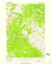
~ Hornet ID topo map, 1:62500 scale, 15 X 15 Minute, Historical, 1957, updated 1958
Hornet, Idaho, USGS topographic map dated 1957.
Includes geographic coordinates (latitude and longitude). This topographic map is suitable for hiking, camping, and exploring, or framing it as a wall map.
Printed on-demand using high resolution imagery, on heavy weight and acid free paper, or alternatively on a variety of synthetic materials.
Topos available on paper, Waterproof, Poly, or Tyvek. Usually shipping rolled, unless combined with other folded maps in one order.
- Product Number: USGS-5436908
- Free digital map download (high-resolution, GeoPDF): Hornet, Idaho (file size: 9 MB)
- Map Size: please refer to the dimensions of the GeoPDF map above
- Weight (paper map): ca. 55 grams
- Map Type: POD USGS Topographic Map
- Map Series: HTMC
- Map Verison: Historical
- Cell ID: 55482
- Scan ID: 239124
- Imprint Year: 1958
- Woodland Tint: Yes
- Aerial Photo Year: 1951
- Field Check Year: 1957
- Datum: NAD27
- Map Projection: Polyconic
- Map published by United States Geological Survey
- Map Language: English
- Scanner Resolution: 600 dpi
- Map Cell Name: Hornet
- Grid size: 15 X 15 Minute
- Date on map: 1957
- Map Scale: 1:62500
- Geographical region: Idaho, United States
Neighboring Maps:
All neighboring USGS topo maps are available for sale online at a variety of scales.
Spatial coverage:
Topo map Hornet, Idaho, covers the geographical area associated the following places:
- Williams Creek - Rush Lake - Lower Hornet Reservoir - Fourth of July Creek - Hornet Creek-Upper Dam - Chipmunk Spring - Crooked River - Paradise Flat - Johnson Creek Park - Dean Spring - Summit Creek - Ellsworth-Middle Dam - Pleasant Ridge - Road Creek - Rocky Comfort Flat - Left Fork North Hornet Creek - Bear Creek - Bear Creek Falls - Wickiup Creek - Cow Creek - Dry Creek - Summers Point - Peck Mountain - Weasel Spring - Mill Creek - North Creek - Badger Gulch - Cottonwood Corrals - Ridge School (historical) - Traction Gulch - Grouse Creek - Upper Dale School - Buck park Guard Station - Alder Gulch - Hanson Creek - Harrington Spring - Pole Creek - Steves Creek - Buck Park - Doe Creek - Lick Creek - Timber Gulch - Summit Gulch - Happy Hollow Ranch Airport (historical) - Trail Hill - Derrick Creek - Placer Creek - Skunk Cabbage Flat - Grouse Spring - Stony Point - Sheep Creek - Cows Horn Gulch - Flat Creek - Pyramid Point - Cottonwood Creek - Lakey Creek - Calf Pen Gulch - Peck Mountain Spring - Bull Gulch - Olive Creek - Dick Ross Creek - Council Division - Long Gulch - North Hornet Mine - Sonner Creek - Ditch Creek - Cuddy Mine - Gladheart Gulch - Horse Spring - Grouse Creek - Willow Spring - Pearl Creek - Weasel Gulch - Corral Creek - Hornet Ranger Station - Hornet Reservoir - Moonshine Creek - Crooked River Point - Clifton Spring - Horse Flat - Devils Slide - Long Gulch Ridge - Fir Creek - West Mill Creek - Hornet Creek-Lower Dam - North Hornet Creek - Lafferty Campground - Deer Creek - Olive Meadows - Robison Gulch - Coyote Gulch - Flying Y Ranch Airport - Thorn Creek - Rock Creek - Spring Creek - Cuddy Mountains
- Map Area ID: AREA4544.75-116.75-116.5
- Northwest corner Lat/Long code: USGSNW45-116.75
- Northeast corner Lat/Long code: USGSNE45-116.5
- Southwest corner Lat/Long code: USGSSW44.75-116.75
- Southeast corner Lat/Long code: USGSSE44.75-116.5
- Northern map edge Latitude: 45
- Southern map edge Latitude: 44.75
- Western map edge Longitude: -116.75
- Eastern map edge Longitude: -116.5


