
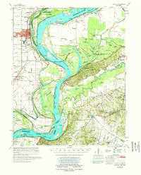
~ Osceola AR topo map, 1:62500 scale, 15 X 15 Minute, Historical, 1977, updated 1977
Osceola, Arkansas, USGS topographic map dated 1977.
Includes geographic coordinates (latitude and longitude). This topographic map is suitable for hiking, camping, and exploring, or framing it as a wall map.
Printed on-demand using high resolution imagery, on heavy weight and acid free paper, or alternatively on a variety of synthetic materials.
Topos available on paper, Waterproof, Poly, or Tyvek. Usually shipping rolled, unless combined with other folded maps in one order.
- Product Number: USGS-5429506
- Free digital map download (high-resolution, GeoPDF): Osceola, Arkansas (file size: 8 MB)
- Map Size: please refer to the dimensions of the GeoPDF map above
- Weight (paper map): ca. 55 grams
- Map Type: POD USGS Topographic Map
- Map Series: HTMC
- Map Verison: Historical
- Cell ID: 60621
- Scan ID: 260227
- Imprint Year: 1977
- Woodland Tint: Yes
- Aerial Photo Year: 1971
- Field Check Year: 1974
- Datum: NAD27
- Map Projection: Polyconic
- Map published by United States Army Corps of Engineers
- Map Language: English
- Scanner Resolution: 600 dpi
- Map Cell Name: Osceola
- Grid size: 15 X 15 Minute
- Date on map: 1977
- Map Scale: 1:62500
- Geographical region: Arkansas, United States
Neighboring Maps:
All neighboring USGS topo maps are available for sale online at a variety of scales.
Spatial coverage:
Topo map Osceola, Arkansas, covers the geographical area associated the following places:
- Oak Grove - Gilt Edge - Osceola - Garland - Burlison - Keyes Point - Randolph - Detroit - Flatwood - Nodena - Elm Grove - Upper Nodena (historical) - Beaver - Rotan - Moran - Jamestown - Walnut Grove - Golddust - Butler - Richardsons - Sans Souci - Grider - Fulton
- Map Area ID: AREA35.7535.5-90-89.75
- Northwest corner Lat/Long code: USGSNW35.75-90
- Northeast corner Lat/Long code: USGSNE35.75-89.75
- Southwest corner Lat/Long code: USGSSW35.5-90
- Southeast corner Lat/Long code: USGSSE35.5-89.75
- Northern map edge Latitude: 35.75
- Southern map edge Latitude: 35.5
- Western map edge Longitude: -90
- Eastern map edge Longitude: -89.75


