
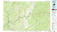
~ Lewisburg WV topo map, 1:100000 scale, 30 X 60 Minute, Historical, 1984, updated 1987
Lewisburg, West Virginia, USGS topographic map dated 1984.
Includes geographic coordinates (latitude and longitude). This topographic map is suitable for hiking, camping, and exploring, or framing it as a wall map.
Printed on-demand using high resolution imagery, on heavy weight and acid free paper, or alternatively on a variety of synthetic materials.
Topos available on paper, Waterproof, Poly, or Tyvek. Usually shipping rolled, unless combined with other folded maps in one order.
- Product Number: USGS-5416108
- Free digital map download (high-resolution, GeoPDF): Lewisburg, West Virginia (file size: 26 MB)
- Map Size: please refer to the dimensions of the GeoPDF map above
- Weight (paper map): ca. 55 grams
- Map Type: POD USGS Topographic Map
- Map Series: HTMC
- Map Verison: Historical
- Cell ID: 67839
- Scan ID: 701701
- Imprint Year: 1987
- Woodland Tint: Yes
- Aerial Photo Year: 1976
- Edit Year: 1984
- Datum: NAD27
- Map Projection: Universal Transverse Mercator
- Map published by United States Geological Survey
- Map Language: English
- Scanner Resolution: 508 dpi
- Map Cell Name: Lewisburg
- Grid size: 30 X 60 Minute
- Date on map: 1984
- Map Scale: 1:100000
- Geographical region: West Virginia, United States
Neighboring Maps:
All neighboring USGS topo maps are available for sale online at a variety of scales.
Spatial coverage:
Topo map Lewisburg, West Virginia, covers the geographical area associated the following places:
- Wiggins - Lillydale - Pedro - Nickells Mill - Lawn - Buckingham Acres - Shawver - Union - Zenith - Meadow Bluff - Farmdale - Hollywood - Hokes Mill - Talcott - Middle Mountain (historical) - Organ Cave - Clintonville - Woodman - Ballengee - Falling Spring - Teaberry - Westwood Place - Barnettown - Nimitz - Stonewall - Glenray - Sims - Layland - Callaghan - Fuller Trailer Park - Mapledale - Raines Corner - Seminole - Jordan Mines - Pittman - Frazier - Willow Bend - White Sulphur Springs - McRoss - Boiling Spring - Barbours Creek - Grassy Meadows - Sandstone - Blue Bend - Cornstalk - Iron Hill Springs - Dickson - Clayton - Santafee - Elmhurst - Pence Springs - McGlone - Marshalltown - Shawvers Crossing - Spring Creek - Wikel - Patton - Junta (historical) - Fort Spring - Barksdale - Claypool - Virginia Mineral Springs - Chestnut Knob - Backbone - Danese - Hematite - Craigs Creek (historical) - Wild Meadow - Gates - Buck - Monitor - Brantville - Dillon - Bellepoint - Maxwelton - Bertha - Judson - Pear (historical) - Fairview (historical) - New Richmond (historical) - Whitcomb (historical) - True - Tuckahoe - Keenan - Piercys Mill - Bellwood - Johnson Crossroads - Anthony - Gardner - Green Sulphur Springs - Dawson - Mountain View Estates - Rolling Hills - Bargers Springs - Glace - Loopemount - Lewisburg - Vale - Spring Dale - Caldwell
- Map Area ID: AREA3837.5-81-80
- Northwest corner Lat/Long code: USGSNW38-81
- Northeast corner Lat/Long code: USGSNE38-80
- Southwest corner Lat/Long code: USGSSW37.5-81
- Southeast corner Lat/Long code: USGSSE37.5-80
- Northern map edge Latitude: 38
- Southern map edge Latitude: 37.5
- Western map edge Longitude: -81
- Eastern map edge Longitude: -80


