
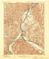
~ Point Pleasant WV topo map, 1:62500 scale, 15 X 15 Minute, Historical, 1929
Point Pleasant, West Virginia, USGS topographic map dated 1929.
Includes geographic coordinates (latitude and longitude). This topographic map is suitable for hiking, camping, and exploring, or framing it as a wall map.
Printed on-demand using high resolution imagery, on heavy weight and acid free paper, or alternatively on a variety of synthetic materials.
Topos available on paper, Waterproof, Poly, or Tyvek. Usually shipping rolled, unless combined with other folded maps in one order.
- Product Number: USGS-5415806
- Free digital map download (high-resolution, GeoPDF): Point Pleasant, West Virginia (file size: 13 MB)
- Map Size: please refer to the dimensions of the GeoPDF map above
- Weight (paper map): ca. 55 grams
- Map Type: POD USGS Topographic Map
- Map Series: HTMC
- Map Verison: Historical
- Cell ID: 61118
- Scan ID: 253805
- Survey Year: 1906
- Datum: NAD
- Map Projection: Polyconic
- Map published by United States Geological Survey
- Map Language: English
- Scanner Resolution: 600 dpi
- Map Cell Name: Point Pleasant
- Grid size: 15 X 15 Minute
- Date on map: 1929
- Map Scale: 1:62500
- Geographical region: West Virginia, United States
Neighboring Maps:
All neighboring USGS topo maps are available for sale online at a variety of scales.
Spatial coverage:
Topo map Point Pleasant, West Virginia, covers the geographical area associated the following places:
- Hanersville - River Bend Subdivision - Hobson Junction - Maxatawney Subdivision - Evans Heights - Mills Village - Redmond - Hobson - Lawnview - Gallipolis - Eno - Kanauga - Sanders Subdivision - Pike Hill - Rayburn - Mapleshade - Plantz Subdivision - Spring Dale Subdivision - Oldtown (historical) - Orchard Hill - West Columbia - Bellmeade - Locust Lane (historical) - Santown - Heights - Bulaville - Flatrock - Kyger - Beech Hill - Lakin - Brighton - Westbrook Village - Stockton (historical) - Gallipolis - Town and Country Estates - Addison - Henderson - Wagner (historical) - Meadowbrook - Cook Subdivision - York - Prospect Hill (historical) - Pleasant Valley Estates - Carlton - Gilmore Heights - Ambrosia - Sassafras - Meadow Look - Mills - Tara Estates - Halliday Heights - Fairview - Greer - Cheshire - Mount Zion Subdivision - Fivemile - Couch - Hawk Subdivision - Point Pleasant - Hallwood - Beale - Gallipolis Ferry - Hedgewood - Hilltop Subdivision - Green Acres - Willow Woods - Maggie - Clipper Mills - Preston Subdivision - Wyoma - Silver Run - Grandview Estates - Iva Dale Subdivision
- Map Area ID: AREA3938.75-82.25-82
- Northwest corner Lat/Long code: USGSNW39-82.25
- Northeast corner Lat/Long code: USGSNE39-82
- Southwest corner Lat/Long code: USGSSW38.75-82.25
- Southeast corner Lat/Long code: USGSSE38.75-82
- Northern map edge Latitude: 39
- Southern map edge Latitude: 38.75
- Western map edge Longitude: -82.25
- Eastern map edge Longitude: -82


