
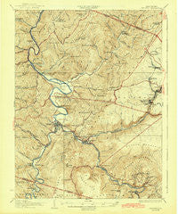
~ Parsons WV topo map, 1:62500 scale, 15 X 15 Minute, Historical, 1926, updated 1942
Parsons, West Virginia, USGS topographic map dated 1926.
Includes geographic coordinates (latitude and longitude). This topographic map is suitable for hiking, camping, and exploring, or framing it as a wall map.
Printed on-demand using high resolution imagery, on heavy weight and acid free paper, or alternatively on a variety of synthetic materials.
Topos available on paper, Waterproof, Poly, or Tyvek. Usually shipping rolled, unless combined with other folded maps in one order.
- Product Number: USGS-5415734
- Free digital map download (high-resolution, GeoPDF): Parsons, West Virginia (file size: 11 MB)
- Map Size: please refer to the dimensions of the GeoPDF map above
- Weight (paper map): ca. 55 grams
- Map Type: POD USGS Topographic Map
- Map Series: HTMC
- Map Verison: Historical
- Cell ID: 60782
- Scan ID: 253770
- Imprint Year: 1942
- Survey Year: 1906
- Datum: NAD
- Map Projection: Polyconic
- Map published by United States Geological Survey
- Map Language: English
- Scanner Resolution: 600 dpi
- Map Cell Name: Parsons
- Grid size: 15 X 15 Minute
- Date on map: 1926
- Map Scale: 1:62500
- Geographical region: West Virginia, United States
Neighboring Maps:
All neighboring USGS topo maps are available for sale online at a variety of scales.
Spatial coverage:
Topo map Parsons, West Virginia, covers the geographical area associated the following places:
- Gladwin - Pettit (historical) - Shafer - Auvil - Pleasant Vale - Lime Rock (historical) - Hambleton - Mackeyville - Lead Mine - Pleasant Run - Richford (historical) - Benbush - Douglas - Location - Pierce - Coketon - Porterwood - Hannahsville - Rosendorf - Davisville - Holly Meadows - Hendricks - Parsons - Saint George - Mill Run (historical) - Bretz - Moore - Clover Run (historical) - Elk
- Map Area ID: AREA39.2539-79.75-79.5
- Northwest corner Lat/Long code: USGSNW39.25-79.75
- Northeast corner Lat/Long code: USGSNE39.25-79.5
- Southwest corner Lat/Long code: USGSSW39-79.75
- Southeast corner Lat/Long code: USGSSE39-79.5
- Northern map edge Latitude: 39.25
- Southern map edge Latitude: 39
- Western map edge Longitude: -79.75
- Eastern map edge Longitude: -79.5


