
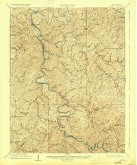
~ Midkiff WV topo map, 1:62500 scale, 15 X 15 Minute, Historical, 1909, updated 1931
Midkiff, West Virginia, USGS topographic map dated 1909.
Includes geographic coordinates (latitude and longitude). This topographic map is suitable for hiking, camping, and exploring, or framing it as a wall map.
Printed on-demand using high resolution imagery, on heavy weight and acid free paper, or alternatively on a variety of synthetic materials.
Topos available on paper, Waterproof, Poly, or Tyvek. Usually shipping rolled, unless combined with other folded maps in one order.
- Product Number: USGS-5415582
- Free digital map download (high-resolution, GeoPDF): Midkiff, West Virginia (file size: 13 MB)
- Map Size: please refer to the dimensions of the GeoPDF map above
- Weight (paper map): ca. 55 grams
- Map Type: POD USGS Topographic Map
- Map Series: HTMC
- Map Verison: Historical
- Cell ID: 57616
- Scan ID: 253690
- Imprint Year: 1931
- Survey Year: 1907
- Datum: NAD
- Map Projection: Polyconic
- Map published by United States Geological Survey
- Map Language: English
- Scanner Resolution: 600 dpi
- Map Cell Name: Midkiff
- Grid size: 15 X 15 Minute
- Date on map: 1909
- Map Scale: 1:62500
- Geographical region: West Virginia, United States
Neighboring Maps:
All neighboring USGS topo maps are available for sale online at a variety of scales.
Spatial coverage:
Topo map Midkiff, West Virginia, covers the geographical area associated the following places:
- Kinder (historical) - Banco - Branchland - Minerva - Redwing - Gill - Bolin (historical) - Hager - Lattin (historical) - Harts - Palermo - Sias - Cuzzie - Spears (historical) - Atenville - Pleasant View - Baber - Myra - Eden Park (historical) - Midkiff - Leet - Hubball - Price - Rockville - Ferrellsburg - Toney - Daisy - Allen (historical) - Jenks - Fry - Bradyville - Spurlockville - Bernie (historical) - Sheridan - Fourteen (historical) - Ranger - Wewanta - Big Creek
- Map Area ID: AREA38.2538-82.25-82
- Northwest corner Lat/Long code: USGSNW38.25-82.25
- Northeast corner Lat/Long code: USGSNE38.25-82
- Southwest corner Lat/Long code: USGSSW38-82.25
- Southeast corner Lat/Long code: USGSSE38-82
- Northern map edge Latitude: 38.25
- Southern map edge Latitude: 38
- Western map edge Longitude: -82.25
- Eastern map edge Longitude: -82


