
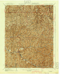
~ Littleton WV topo map, 1:62500 scale, 15 X 15 Minute, Historical, 1926, updated 1940
Littleton, West Virginia, USGS topographic map dated 1926.
Includes geographic coordinates (latitude and longitude). This topographic map is suitable for hiking, camping, and exploring, or framing it as a wall map.
Printed on-demand using high resolution imagery, on heavy weight and acid free paper, or alternatively on a variety of synthetic materials.
Topos available on paper, Waterproof, Poly, or Tyvek. Usually shipping rolled, unless combined with other folded maps in one order.
- Product Number: USGS-5415482
- Free digital map download (high-resolution, GeoPDF): Littleton, West Virginia (file size: 14 MB)
- Map Size: please refer to the dimensions of the GeoPDF map above
- Weight (paper map): ca. 55 grams
- Map Type: POD USGS Topographic Map
- Map Series: HTMC
- Map Verison: Historical
- Cell ID: 56784
- Scan ID: 253631
- Imprint Year: 1940
- Survey Year: 1903
- Datum: NAD
- Map Projection: Polyconic
- Map published by United States Geological Survey
- Map Language: English
- Scanner Resolution: 600 dpi
- Map Cell Name: Littleton
- Grid size: 15 X 15 Minute
- Date on map: 1926
- Map Scale: 1:62500
- Geographical region: West Virginia, United States
Neighboring Maps:
All neighboring USGS topo maps are available for sale online at a variety of scales.
Spatial coverage:
Topo map Littleton, West Virginia, covers the geographical area associated the following places:
- Mobley - Suter (historical) - Kodol - Pricetown - Denver Heights - Dulaney - Wheat - Hazel - Allister - West - Fairview - Halls Mills - Bannen - Hoyt - Littleton - Burchfield - Big Run - Jacksonburg - Archer - Howard - Galmish - Shenango (historical) - Atwood - Kingstown - Barker - Carbide - Sincerity - Rockport - Onie (historical) - Howard (historical) - Wade - Georgetown - Dean - Hastings - Peabody - Knob Fork - Pine Grove - Anthem - Piney - Saint Joseph - Five Points (historical) - Millsboro - Four Mile - Coburn - Bane - Wileyville - King - Newdale - Endicott - Bebee - Uniontown - Maud - Reader
- Map Area ID: AREA39.7539.5-80.75-80.5
- Northwest corner Lat/Long code: USGSNW39.75-80.75
- Northeast corner Lat/Long code: USGSNE39.75-80.5
- Southwest corner Lat/Long code: USGSSW39.5-80.75
- Southeast corner Lat/Long code: USGSSE39.5-80.5
- Northern map edge Latitude: 39.75
- Southern map edge Latitude: 39.5
- Western map edge Longitude: -80.75
- Eastern map edge Longitude: -80.5


