
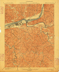
~ Guyandot WV topo map, 1:62500 scale, 15 X 15 Minute, Historical, 1902, updated 1910
Guyandot, West Virginia, USGS topographic map dated 1902.
Includes geographic coordinates (latitude and longitude). This topographic map is suitable for hiking, camping, and exploring, or framing it as a wall map.
Printed on-demand using high resolution imagery, on heavy weight and acid free paper, or alternatively on a variety of synthetic materials.
Topos available on paper, Waterproof, Poly, or Tyvek. Usually shipping rolled, unless combined with other folded maps in one order.
- Product Number: USGS-5415366
- Free digital map download (high-resolution, GeoPDF): Guyandot, West Virginia (file size: 12 MB)
- Map Size: please refer to the dimensions of the GeoPDF map above
- Weight (paper map): ca. 55 grams
- Map Type: POD USGS Topographic Map
- Map Series: HTMC
- Map Verison: Historical
- Cell ID: 54950
- Scan ID: 253563
- Imprint Year: 1910
- Survey Year: 1901
- Datum: Unstated
- Map Projection: Unstated
- Map published by United States Geological Survey
- Map Language: English
- Scanner Resolution: 600 dpi
- Map Cell Name: Guyandot
- Grid size: 15 X 15 Minute
- Date on map: 1902
- Map Scale: 1:62500
- Geographical region: West Virginia, United States
Neighboring Maps:
All neighboring USGS topo maps are available for sale online at a variety of scales.
Spatial coverage:
Topo map Guyandot, West Virginia, covers the geographical area associated the following places:
- Symmes Park - Riverview - Miller Estates - Harveytown - Lavalette - Winslow - Freeman Estates - Dickson - Enslow Park Place - Garden Farms - Bradrick - Belle Court - Rockwood - Bartramville - Marcum Terrace - Mott - Whitaker Terrace - Chesapeake - West Huntington - Chancellor Hills - Lakeland - West Pea Ridge - Northwood - Bowen - Owens Crossing - Edgemont - Booton - Guyan Estates - Sunny Acres - Stamford Park - Gillette - Lock - Cox Landing - Melissa - Timberlake - Gaylersville - Johnson (historical) - Tallwood Acres - Wilson - Home Park - East Pea Ridge - Plantation Estates - Guyandotte - Belmont Park - Pea Ridge - Shoals - Northcott Court - Bartram (historical) - Riverview Estates - Brownstown (historical) - Brookover Estates - Crescent Lake - Beverly Hills - Beverly Hills - Grandview Heights - Hillview - Cranford - Barboursville - Anita Heights - Brentwood - Washington Square - Fair Place - Guthrie - Le Mae - Rome - Hodges - Ridgewood - Gardner Terrace - Getaway - Ardel - Martha - Altizer - Corryville - Sarah - Reid - Fairland - Proctorville - Park Hills - Huntington - Riverside Terrace - Campbell Park
- Map Area ID: AREA38.538.25-82.5-82.25
- Northwest corner Lat/Long code: USGSNW38.5-82.5
- Northeast corner Lat/Long code: USGSNE38.5-82.25
- Southwest corner Lat/Long code: USGSSW38.25-82.5
- Southeast corner Lat/Long code: USGSSE38.25-82.25
- Northern map edge Latitude: 38.5
- Southern map edge Latitude: 38.25
- Western map edge Longitude: -82.5
- Eastern map edge Longitude: -82.25


