
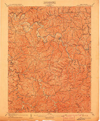
~ Arnoldsburg WV topo map, 1:62500 scale, 15 X 15 Minute, Historical, 1907
Arnoldsburg, West Virginia, USGS topographic map dated 1907.
Includes geographic coordinates (latitude and longitude). This topographic map is suitable for hiking, camping, and exploring, or framing it as a wall map.
Printed on-demand using high resolution imagery, on heavy weight and acid free paper, or alternatively on a variety of synthetic materials.
Topos available on paper, Waterproof, Poly, or Tyvek. Usually shipping rolled, unless combined with other folded maps in one order.
- Product Number: USGS-5414884
- Free digital map download (high-resolution, GeoPDF): Arnoldsburg, West Virginia (file size: 12 MB)
- Map Size: please refer to the dimensions of the GeoPDF map above
- Weight (paper map): ca. 55 grams
- Map Type: POD USGS Topographic Map
- Map Series: HTMC
- Map Verison: Historical
- Cell ID: 50690
- Scan ID: 253318
- Survey Year: 1905
- Datum: Unstated
- Map Projection: Unstated
- Map published by United States Geological Survey
- Map Language: English
- Scanner Resolution: 600 dpi
- Map Cell Name: Arnoldsburg
- Grid size: 15 X 15 Minute
- Date on map: 1907
- Map Scale: 1:62500
- Geographical region: West Virginia, United States
Neighboring Maps:
All neighboring USGS topo maps are available for sale online at a variety of scales.
Spatial coverage:
Topo map Arnoldsburg, West Virginia, covers the geographical area associated the following places:
- Dodrill - White Pine - Rocksdale - Index (historical) - Leatherbark - Oak Hill - Hattie - Otto - Hathaway - Bigbend - Beech - Big Springs - Rhoda - Joker - Pleasant Hill - Arnoldsburg - Staten - Cremo - Sycamore - Annamoriah - Henrietta - Purdy - Cabot Station - Creston Flats - Richardson - Russet - Millstone - Ayers - Altizer - Poling Run (historical) - Adam - Pink - Nobe - Lovada - Liberty Hill - Sand Ridge - Five Forks - Grantsville - Mount Zion - Hur - Tristan
- Map Area ID: AREA3938.75-81.25-81
- Northwest corner Lat/Long code: USGSNW39-81.25
- Northeast corner Lat/Long code: USGSNE39-81
- Southwest corner Lat/Long code: USGSSW38.75-81.25
- Southeast corner Lat/Long code: USGSSE38.75-81
- Northern map edge Latitude: 39
- Southern map edge Latitude: 38.75
- Western map edge Longitude: -81.25
- Eastern map edge Longitude: -81


