
~ Meadow Creek WV topo map, 1:48000 scale, 15 X 15 Minute, Historical, 1912
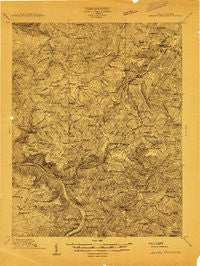
Meadow Creek, West Virginia, USGS topographic map dated 1912.
Includes geographic coordinates (latitude and longitude). This topographic map is suitable for hiking, camping, and exploring, or framing it as a wall map.
Printed on-demand using high resolution imagery, on heavy weight and acid free paper, or alternatively on a variety of synthetic materials.
Topos available on paper, Waterproof, Poly, or Tyvek. Usually shipping rolled, unless combined with other folded maps in one order.
- Product Number: USGS-5414856
- Free digital map download (high-resolution, GeoPDF): Meadow Creek, West Virginia (file size: 19 MB)
- Map Size: please refer to the dimensions of the GeoPDF map above
- Weight (paper map): ca. 55 grams
- Map Type: POD USGS Topographic Map
- Map Series: HTMC
- Map Verison: Historical
- Cell ID: 57435
- Scan ID: 253262
- Survey Year: 1912
- Datum: Unstated
- Map Projection: Unstated
- Advance: Yes
- Map published by United States Geological Survey
- Keywords: Nonstandard Press Run
- Map Language: English
- Scanner Resolution: 600 dpi
- Map Cell Name: Meadow Creek
- Grid size: 15 X 15 Minute
- Date on map: 1912
- Map Scale: 1:48000
- Geographical region: West Virginia, United States
Neighboring Maps:
All neighboring USGS topo maps are available for sale online at a variety of scales.
Spatial coverage:
Topo map Meadow Creek, West Virginia, covers the geographical area associated the following places:
- Landisburg - Lockbridge - Sandstone - Abraham - Ramp - Maywood - Danese - Spring Dale - Backus - Beelick Knob - Beurytown - Green Sulphur Springs - Lawton - New Richmond (historical) - Greenwood (historical) - Red Spring - Rainelle - Sturgeon Branch (historical) - Layland - Kathryn - Bellwood - Lilly Park - Elton - Sims - Shawver - Meadow Creek - Maplewood - Hemlock - Lawn - Dillon - Claypool - Laurel Creek - Meadow Bridge - Layland Heights - Pear (historical) - Pittman - Bragg - Chestnut Knob - Crickmer - Tina (historical)
- Map Area ID: AREA3837.75-81-80.75
- Northwest corner Lat/Long code: USGSNW38-81
- Northeast corner Lat/Long code: USGSNE38-80.75
- Southwest corner Lat/Long code: USGSSW37.75-81
- Southeast corner Lat/Long code: USGSSE37.75-80.75
- Northern map edge Latitude: 38
- Southern map edge Latitude: 37.75
- Western map edge Longitude: -81
- Eastern map edge Longitude: -80.75


