
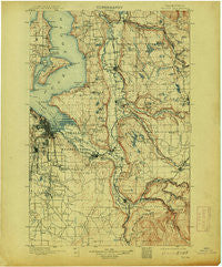
~ Tacoma WA topo map, 1:125000 scale, 30 X 30 Minute, Historical, 1900, updated 1913
Tacoma, Washington, USGS topographic map dated 1900.
Includes geographic coordinates (latitude and longitude). This topographic map is suitable for hiking, camping, and exploring, or framing it as a wall map.
Printed on-demand using high resolution imagery, on heavy weight and acid free paper, or alternatively on a variety of synthetic materials.
Topos available on paper, Waterproof, Poly, or Tyvek. Usually shipping rolled, unless combined with other folded maps in one order.
- Product Number: USGS-5411444
- Free digital map download (high-resolution, GeoPDF): Tacoma, Washington (file size: 10 MB)
- Map Size: please refer to the dimensions of the GeoPDF map above
- Weight (paper map): ca. 55 grams
- Map Type: POD USGS Topographic Map
- Map Series: HTMC
- Map Verison: Historical
- Cell ID: 66747
- Scan ID: 244182
- Imprint Year: 1913
- Survey Year: 1895
- Datum: Unstated
- Map Projection: Unstated
- Map published by United States Geological Survey
- Map Language: English
- Scanner Resolution: 600 dpi
- Map Cell Name: Tacoma
- Grid size: 30 X 30 Minute
- Date on map: 1900
- Map Scale: 1:125000
- Geographical region: Washington, United States
Neighboring Maps:
All neighboring USGS topo maps are available for sale online at a variety of scales.
Spatial coverage:
Topo map Tacoma, Washington, covers the geographical area associated the following places:
- Circle K Mobile Home Park - Bonavilla Mobile Home Park - Laurelwood Mobile Home Park - The Ridge Mobile Home Park - Meridian Heights - Maplewood Heights - Greenwood Mobile Home Park - Riverton - Caledonia - Camelot Square Mobile Home Park - Mirrormount Estates - Sunset Terrace Mobile Home Park - Tanwax - Lake Meridian Estates Mobile Home Park - Rio Verde Mobile Estates - Foster - Don Juan Mobile Home Park - Vermontville (historical) - Harvest Gate Mobile Home Park - East Renton Highlands - Thrift - Sumner - View Crest Mobile Manor - Mountain Valley Mobile Home Park - Federal Way - Kitts Corner - Lakeland - Belmor Mobile Home Park - Danville - Heather Hills Mobile Home Park - Croker - Lakeside Terrace Mobile Home Park - Auburn - Vashon - Edgewood - Cottonwood Mobile Home Park - Dorre Don - Browns Point - Ellisport - Elliott - Firwood Mobile Home Park - View Crest Mobile Home Park - Maple Valley Heights - Dockton - South Prairie - Wonderland Mobile Homes - Monta Vista - Orchard Grove - North West Mobile Home Park - Atkinson - Harvard View Mobile Home Park - The River Mobile Estates - Algona - Vue Mobile Home Park - Central Valley Mobile Home Park - Buenna - Alderton - Frederickson - Arcadia - Evergreen Manor Mobile Home Park - Glendale Mobile Home Park - Southern Heights - Horseshoe Acres Mobile Home Park - McMillan Village Mobile Home Park - Old Tacoma - Pleasant Valley Manor Mobile Home Park - Golden Given Mobile Home Park - Vaugans Mobile Home Park - Harbor Heights - Mirror Lake - Wilderness - Angle Lake Mobile Home Park - Kloshe Illahee Mobile Home Park - Parkland Mobile Village - Wilkeson Gardens Mobile Home Park - Palisades Mobile Home Estates - Mount Tacoma Mobile Park - Hi - Land Mobile Manor - Hylebos Creek Mobile Home Park - Auburn Green Mobile Home Park - Lakeview - Pinecrest Mobile Home Park - Loveland - College Place Mobile Home Park - Osceola - Shadow Pines Mobile Estates - Cascade Green Mobile Home Park - Auburn Manor Community Mobile Home Park - Bonney Lake - Lake Money Smith Estates Mobile Home Park - Carriage Mobile Home Court - Summer Villa Estates Mobile Home Park - Tyee Valley Mobile Manor - Burien - Franklin Pierce Mobile Estates - Bethel Park - Hillsdale - Spanaway Mobile Village - Evansville - Burnett
- Map Area ID: AREA47.547-122.5-122
- Northwest corner Lat/Long code: USGSNW47.5-122.5
- Northeast corner Lat/Long code: USGSNE47.5-122
- Southwest corner Lat/Long code: USGSSW47-122.5
- Southeast corner Lat/Long code: USGSSE47-122
- Northern map edge Latitude: 47.5
- Southern map edge Latitude: 47
- Western map edge Longitude: -122.5
- Eastern map edge Longitude: -122


