
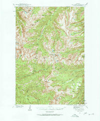
~ Mt Cowen MT topo map, 1:62500 scale, 15 X 15 Minute, Historical, 1940, updated 1963
Mt Cowen, Montana, USGS topographic map dated 1940.
Includes geographic coordinates (latitude and longitude). This topographic map is suitable for hiking, camping, and exploring, or framing it as a wall map.
Printed on-demand using high resolution imagery, on heavy weight and acid free paper, or alternatively on a variety of synthetic materials.
Topos available on paper, Waterproof, Poly, or Tyvek. Usually shipping rolled, unless combined with other folded maps in one order.
- Product Number: USGS-5401144
- Free digital map download (high-resolution, GeoPDF): Mt Cowen, Montana (file size: 12 MB)
- Map Size: please refer to the dimensions of the GeoPDF map above
- Weight (paper map): ca. 55 grams
- Map Type: POD USGS Topographic Map
- Map Series: HTMC
- Map Verison: Historical
- Cell ID: 57953
- Scan ID: 268162
- Imprint Year: 1963
- Woodland Tint: Yes
- Visual Version Number: 2
- Datum: NAD27
- Map Projection: Polyconic
- Map published by United States Geological Survey
- Map Language: English
- Scanner Resolution: 600 dpi
- Map Cell Name: Mount Cowen
- Grid size: 15 X 15 Minute
- Date on map: 1940
- Map Scale: 1:62500
- Geographical region: Montana, United States
Neighboring Maps:
All neighboring USGS topo maps are available for sale online at a variety of scales.
Spatial coverage:
Topo map Mt Cowen, Montana, covers the geographical area associated the following places:
- West Fork West Boulder River - Crystal Lake - Jewel Lake - Alpine Lake - Fourmile Creek - Marten Peak - Crow Mountain - Falls Creek - Pyramid Trail - Gallatin National Forest - Speculator Creek Mine - West Boulder Plateau - South Fork Bridge Creek - Wallace Creek Trail - Second Creek - Mill Creek Pass - Marie Creek - Carbonate Mountain - Three Creeks - Lambert Creek - War Eagle Mountain - The Needles - Agate Springs - Elbow Lake - Beaver Meadows - Mount Cowen - Pine Creek Lake - Tumble Creek - Tuscarora Creek - Boulder Mountain - Bridge Lake - Kaufman Lake - Mount McKnight - Colley Creek - Sidehill Trail - Coyote Creek - West Boulder Lake - Hawkwood School (historical) - Hawkwood Post Office (historical) - The Pyramid - Silver Lake - Trail Creek - Trapper Lake - Black Mountain - Trapper Creek - East Fork West Boulder River - Silver Pass - Lake McKnight - End Lookout - Anderson Creek - Jungle Creek
- Map Area ID: AREA45.545.25-110.5-110.25
- Northwest corner Lat/Long code: USGSNW45.5-110.5
- Northeast corner Lat/Long code: USGSNE45.5-110.25
- Southwest corner Lat/Long code: USGSSW45.25-110.5
- Southeast corner Lat/Long code: USGSSE45.25-110.25
- Northern map edge Latitude: 45.5
- Southern map edge Latitude: 45.25
- Western map edge Longitude: -110.5
- Eastern map edge Longitude: -110.25


