
~ Tule Valley East MT topo map, 1:24000 scale, 7.5 X 7.5 Minute, Historical, 1983, updated 1983
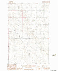
Tule Valley East, Montana, USGS topographic map dated 1983.
Includes geographic coordinates (latitude and longitude). This topographic map is suitable for hiking, camping, and exploring, or framing it as a wall map.
Printed on-demand using high resolution imagery, on heavy weight and acid free paper, or alternatively on a variety of synthetic materials.
Topos available on paper, Waterproof, Poly, or Tyvek. Usually shipping rolled, unless combined with other folded maps in one order.
- Product Number: USGS-5399784
- Free digital map download (high-resolution, GeoPDF): Tule Valley East, Montana (file size: 10 MB)
- Map Size: please refer to the dimensions of the GeoPDF map above
- Weight (paper map): ca. 55 grams
- Map Type: POD USGS Topographic Map
- Map Series: HTMC
- Map Verison: Historical
- Cell ID: 45889
- Scan ID: 267290
- Imprint Year: 1983
- Woodland Tint: Yes
- Aerial Photo Year: 1975
- Edit Year: 1983
- Field Check Year: 1977
- Datum: NAD27
- Map Projection: Lambert Conformal Conic
- Provisional map: Yes
- Map published by United States Geological Survey
- Map Language: English
- Scanner Resolution: 600 dpi
- Map Cell Name: Tule Valley East
- Grid size: 7.5 X 7.5 Minute
- Date on map: 1983
- Map Scale: 1:24000
- Geographical region: Montana, United States
Neighboring Maps:
All neighboring USGS topo maps are available for sale online at a variety of scales.
Spatial coverage:
Topo map Tule Valley East, Montana, covers the geographical area associated the following places:
- 30N48E17CCCC01 Well - 30N47E24ACDC01 Well - Structure Number 95 Dam - 29N48E08CBBB01 Well - 30N47E24DABA01 Well - 29N48E19CDCB01 Well - 30N48E07BAAB01 Well - Tule Valley - 30N48E29ACDC01 Well - Woods School (historical) - 29N47E15BAAD01 Well - North Fork Tule Creek - 30N48E07BAAB02 Well - 30N48E32BCBA01 Well - 30N48E32BCBC01 Well - Expanse Post Office (historical) - 30N47E12ADCC01 Well - Fort Peck Indian Reservation - Dry Fork School (historical)
- Map Area ID: AREA48.37548.25-105.625-105.5
- Northwest corner Lat/Long code: USGSNW48.375-105.625
- Northeast corner Lat/Long code: USGSNE48.375-105.5
- Southwest corner Lat/Long code: USGSSW48.25-105.625
- Southeast corner Lat/Long code: USGSSE48.25-105.5
- Northern map edge Latitude: 48.375
- Southern map edge Latitude: 48.25
- Western map edge Longitude: -105.625
- Eastern map edge Longitude: -105.5


