
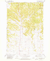
~ Park Coulee MT topo map, 1:24000 scale, 7.5 X 7.5 Minute, Historical, 1980, updated 1980
Park Coulee, Montana, USGS topographic map dated 1980.
Includes geographic coordinates (latitude and longitude). This topographic map is suitable for hiking, camping, and exploring, or framing it as a wall map.
Printed on-demand using high resolution imagery, on heavy weight and acid free paper, or alternatively on a variety of synthetic materials.
Topos available on paper, Waterproof, Poly, or Tyvek. Usually shipping rolled, unless combined with other folded maps in one order.
- Product Number: USGS-5397404
- Free digital map download (high-resolution, GeoPDF): Park Coulee, Montana (file size: 11 MB)
- Map Size: please refer to the dimensions of the GeoPDF map above
- Weight (paper map): ca. 55 grams
- Map Type: POD USGS Topographic Map
- Map Series: HTMC
- Map Verison: Historical
- Cell ID: 34216
- Scan ID: 265922
- Imprint Year: 1980
- Woodland Tint: Yes
- Aerial Photo Year: 1973
- Edit Year: 1980
- Field Check Year: 1974
- Datum: NAD27
- Map Projection: Lambert Conformal Conic
- Map published by United States Geological Survey
- Map Language: English
- Scanner Resolution: 600 dpi
- Map Cell Name: Park Coulee
- Grid size: 7.5 X 7.5 Minute
- Date on map: 1980
- Map Scale: 1:24000
- Geographical region: Montana, United States
Neighboring Maps:
All neighboring USGS topo maps are available for sale online at a variety of scales.
Spatial coverage:
Topo map Park Coulee, Montana, covers the geographical area associated the following places:
- 06N26E26AACD01 Well - Thirtymile Ranch - 06N26E26ACAA01 Well - 04N27E03ABCA01 Well - 05N27E06DBAA01 Well - 05N27E06CAD_01 Well - 05N26E01AAA_01 Spring - 06N26E35DAAA01 Well - 06N26E36CCBA01 Well - 06N26E26ADBB01 Well - Buckey Post Office (historical) - 05N27E08BCC_01 Well - Summit Post Office (historical) - Park Coulee - 05N27E07DCDD01 Well - Thirty Mile (historical) - 06N26E27CBDC01 Well - 05N26E22ABBD01 Well - 05N27E18AADD01 Well - 05N26E03BDDD01 Well - 06N26E35AAAD01 Well - 06N26E36DCC_01 Well - 05N27E29CCDA01 Well - 06N26E26ACC_01 Well - 05N26E03DDAA01 Well - 05N26E22BBBB01 Well - 05N26E32DCBB01 Well - 06N27E32CCAD01 Well - 06N26E27ADAD01 Well - 06N27E31DBAB01 Well
- Map Area ID: AREA46.2546.125-108.5-108.375
- Northwest corner Lat/Long code: USGSNW46.25-108.5
- Northeast corner Lat/Long code: USGSNE46.25-108.375
- Southwest corner Lat/Long code: USGSSW46.125-108.5
- Southeast corner Lat/Long code: USGSSE46.125-108.375
- Northern map edge Latitude: 46.25
- Southern map edge Latitude: 46.125
- Western map edge Longitude: -108.5
- Eastern map edge Longitude: -108.375


