
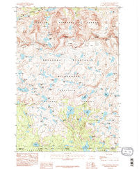
~ Castle Mountain MT topo map, 1:24000 scale, 7.5 X 7.5 Minute, Historical, 1986, updated 1986
Castle Mountain, Montana, USGS topographic map dated 1986.
Includes geographic coordinates (latitude and longitude). This topographic map is suitable for hiking, camping, and exploring, or framing it as a wall map.
Printed on-demand using high resolution imagery, on heavy weight and acid free paper, or alternatively on a variety of synthetic materials.
Topos available on paper, Waterproof, Poly, or Tyvek. Usually shipping rolled, unless combined with other folded maps in one order.
- Product Number: USGS-5392200
- Free digital map download (high-resolution, GeoPDF): Castle Mountain, Montana (file size: 16 MB)
- Map Size: please refer to the dimensions of the GeoPDF map above
- Weight (paper map): ca. 55 grams
- Map Type: POD USGS Topographic Map
- Map Series: HTMC
- Map Verison: Historical
- Cell ID: 7583
- Scan ID: 262887
- Imprint Year: 1986
- Woodland Tint: Yes
- Aerial Photo Year: 1981
- Edit Year: 1986
- Field Check Year: 1983
- Datum: NAD27
- Map Projection: Lambert Conformal Conic
- Provisional map: Yes
- Map published by United States Geological Survey
- Map Language: English
- Scanner Resolution: 600 dpi
- Map Cell Name: Castle Mountain
- Grid size: 7.5 X 7.5 Minute
- Date on map: 1986
- Map Scale: 1:24000
- Geographical region: Montana, United States
Neighboring Maps:
All neighboring USGS topo maps are available for sale online at a variety of scales.
Spatial coverage:
Topo map Castle Mountain, Montana, covers the geographical area associated the following places:
- Lake Susanne - Lake Elaine - Jorden Lake - Red Rock Lakes - Trail Lake - Kidney Lake - North Hidden Lake - Summerville Lake - Lennon Lake - Sierra Creek - Scat Lake - Lake at Falls - Charlie Falls - Copepod Lake - Castle Rock Mountain - Flat Rock Lake - Falls Creek Lake - Martin Lake - Copeland Lake - Indian Knife Lake - Triangle Lake - Planaria Lake - Shrimp Lake - Fritter Lake - Widowed Lake - Green Lake - Robble Lake - Impasse Falls - Sundance Glacier - Estelle Lake - Gravel Lake - Burnt Bacon Lake - Navajo Tarn - Picket Lake - Hermit Lake - Hatchet Lake - Lake Creek - Erratic Lake - Castle Lake - Crazy Mountain - Jenny Lake - Little Scat Lake - Farley Lake - Heart Lake - Snowbank Mountain - Desolation Lake - Castle Mountain - Otter Lake - Summit Lake - Castle Rock Glacier - Pleiades Lakes - Granite Creek - Wright Lake - Snowbank Lake - Pat Lake - Crystal Lake - Martin Lake - Whitcomb Lake - Throop Lake - Maryott Lake - Hidden Lake - Alp Lake - Red Storm Lake - Summit Mountain - Glissade Lake - Anvil Lake - Elpestrine Lake - Castle Rock Spire - Snail Lake - Anchor Lake - Cladocera Lake - Shrew Lake - Duggan Lake - Z Lake - Liver Lake - Rachel Lake - Vogel Lake - Elephant Lake - Till Lake - Rock Tree Lake - Thiel Lake - Bergschrund Lake - Varve Lake - Spogen Lake - Big Butte Lake - Falls Creek - Ghost Lake - Snowbank Glacier
- Map Area ID: AREA45.12545-109.75-109.625
- Northwest corner Lat/Long code: USGSNW45.125-109.75
- Northeast corner Lat/Long code: USGSNE45.125-109.625
- Southwest corner Lat/Long code: USGSSW45-109.75
- Southeast corner Lat/Long code: USGSSE45-109.625
- Northern map edge Latitude: 45.125
- Southern map edge Latitude: 45
- Western map edge Longitude: -109.75
- Eastern map edge Longitude: -109.625


