
~ Wilmington DE topo map, 1:250000 scale, 1 X 2 Degree, Historical, 1972, updated 1976
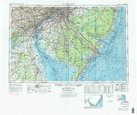
Wilmington, Delaware, USGS topographic map dated 1972.
Includes geographic coordinates (latitude and longitude). This topographic map is suitable for hiking, camping, and exploring, or framing it as a wall map.
Printed on-demand using high resolution imagery, on heavy weight and acid free paper, or alternatively on a variety of synthetic materials.
Topos available on paper, Waterproof, Poly, or Tyvek. Usually shipping rolled, unless combined with other folded maps in one order.
- Product Number: USGS-5390398
- Free digital map download (high-resolution, GeoPDF): Wilmington, Delaware (file size: 28 MB)
- Map Size: please refer to the dimensions of the GeoPDF map above
- Weight (paper map): ca. 55 grams
- Map Type: POD USGS Topographic Map
- Map Series: HTMC
- Map Verison: Historical
- Cell ID: 69102
- Scan ID: 255823
- Imprint Year: 1976
- Woodland Tint: Yes
- Visual Version Number: 2
- Edit Year: 1972
- Field Check Year: 1966
- Datum: Unstated
- Map Projection: Transverse Mercator
- Map published by United States Army
- Map Language: English
- Scanner Resolution: 600 dpi
- Map Cell Name: Wilmington
- Grid size: 1 X 2 Degree
- Date on map: 1972
- Map Scale: 1:250000
- Geographical region: Delaware, United States
Neighboring Maps:
All neighboring USGS topo maps are available for sale online at a variety of scales.
Spatial coverage:
Topo map Wilmington, Delaware, covers the geographical area associated the following places:
- Rogers Corners - Cypress Gardens - Butlers Place - Huntley Circle - West Gate Hills - Dunbarton - Delaware Gardens - Gristmill Woods - Miami Beach - Kiamensi - Padens Corner Mobile Home Park - Society Hill - Fairview - Erlton - Stratford - Brooklawn - Eder - Birds Corner - Sheppards Mill - Bell Road (historical) - Blake - Newport - Kentmore Park - Lima Estates - Elkton Landing - Piermont Woods - Green Bank - Eastburn Acres - Frasers Corner - Armstrong - South Egg Harbor - Bowers Beach - Rutherford - Secane - Bulltown - Simmonstown - Williamstown - Prospect - Bozuretown - Gilpin Farms - Kay Gardens - Pigeon Run - Venice Park - Alban Park - Unicorn Manor - Marplewood Villa - Herman - Petersburg - London Village - Canby Park Estates - Hilltop - Grubbs Landing - West Atlantic City - Aniline Village - Morris Estates - Greentree - Planters Woods - Lombard Acres - Sinnickson Landing - Burrs Mill - Baldwin - Cobblestones at Thornbury - Willistown Chase - Brookville - Newport - Forest Green Court - Weidman - Blackiston - Oakbourne - Edgewood Hills - Watsons Corner - Wellington Hills - Anneville - Lawnside - Colonial Heights - Deer Park - Greenville - Four Seasons - Fortescue - Pleasant Hill - Faulkland - Bethel - Pleasant Mills - Scots Glen - Greens of Dover - Lamatan I - Harding - Glen Riddle - Edgehill Acres - Westcotville - Wylie Farms - Talcose - Taunton Lake - Friendship - Downs Farms - Mayview Manor - Lords Corner - Mendenhall Village - Iron Hills Apartments - Estellville
- Map Area ID: AREA4039-76-74
- Northwest corner Lat/Long code: USGSNW40-76
- Northeast corner Lat/Long code: USGSNE40-74
- Southwest corner Lat/Long code: USGSSW39-76
- Southeast corner Lat/Long code: USGSSE39-74
- Northern map edge Latitude: 40
- Southern map edge Latitude: 39
- Western map edge Longitude: -76
- Eastern map edge Longitude: -74


