
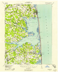
~ Rehoboth DE topo map, 1:62500 scale, 15 X 15 Minute, Historical, 1938, updated 1958
Rehoboth, Delaware, USGS topographic map dated 1938.
Includes geographic coordinates (latitude and longitude). This topographic map is suitable for hiking, camping, and exploring, or framing it as a wall map.
Printed on-demand using high resolution imagery, on heavy weight and acid free paper, or alternatively on a variety of synthetic materials.
Topos available on paper, Waterproof, Poly, or Tyvek. Usually shipping rolled, unless combined with other folded maps in one order.
- Product Number: USGS-5390346
- Free digital map download (high-resolution, GeoPDF): Rehoboth, Delaware (file size: 7 MB)
- Map Size: please refer to the dimensions of the GeoPDF map above
- Weight (paper map): ca. 55 grams
- Map Type: POD USGS Topographic Map
- Map Series: HTMC
- Map Verison: Historical
- Cell ID: 61545
- Scan ID: 255776
- Imprint Year: 1958
- Woodland Tint: Yes
- Visual Version Number: 1
- Aerial Photo Year: 1938
- Survey Year: 1917
- Datum: NAD
- Map Projection: Polyconic
- Map published by United States Army Corps of Engineers
- Map published by United States Department of War
- Map Language: English
- Scanner Resolution: 600 dpi
- Map Cell Name: Rehoboth
- Grid size: 15 X 15 Minute
- Date on map: 1938
- Map Scale: 1:62500
- Geographical region: Delaware, United States
Neighboring Maps:
All neighboring USGS topo maps are available for sale online at a variety of scales.
Spatial coverage:
Topo map Rehoboth, Delaware, covers the geographical area associated the following places:
- Sea Spray Village - Cuelen Acres - Old Landing Woods - Millville - Log Cabin Mobile Home Park - Greens Landing - Blackwater - Hollyville - Bay Vista - The Glade - Gull Point - Carpenters Corner - Dodds Addition - Country Estates - Driftwood Village Mobile Home Park - Sussex Shores - Blackwater Village - River Village Mobile Home Park - Sea Del Estates - Webb Landing - Lingo Estate Mobile Home Park - Shawns Hideaway Mobile Home Park - Denton Woods Mobile Home Park - Riverdale - Strawberry Landing - Miller Creek Park Mobile Home Park - Cedar Shores - Phil Mar Estates - Pond Acres - Steele Acres - Colonial East Mobile Home Park - River Village II Mobile Home Park - Bay Shore Hills - Tri-State Mobile Home Park - Dagsboro - Shockley Manor - Oak Orchard - Club House Landing - Robinson Landing - Silver Lake Manor - Indian River Acres - Fox Run Mobile Home Park - Pinepoint Mobile Home Park - Long Acres - The Landing - Sea Colony East - Roxford - Sea Farers Village - Meyle Estates - Sea Air Mobile Home Park - West Rehoboth - Hollymount - Goslee Mill - Enchanted Acres Mobile Home Park - Ben Robins Landing - Holly Pines Mobile Home Park - Mallard Point - Murray Estates - Bay City Mobile Home Park - Beaver Dam Acres - Angola Beach Mobile Home Park - Midway Park Subdivision - Edgewood Manor - Dogwood Acres Mobile Home Park - Seabreeze - Collins Creek Estates - Ocean Village - Five Points - Bayberry Dunes - Truitts Park - Midway - Jimtown - Bay Shore Mobile Home Park - Bottom Hills - Maplewood - Hillcrest Acres Mobile Home Park - Long Neck - Fishermans Park Mobile Home Park - Midway Estates - Lazy Lagoon Mobile Home Park - Herring Creek Estates - Belltown - Tower Shores - Irons Lane Landing - Shockley Heights - Breezewood - Fairmount - Cool Spring - The Landing - Indian Beach - Harmon - Arbre Park Mobile Home Park - Dewey Beach - Tru Vale Acres - The Reservation - Angola Neck Park Mobile Home Park - Long Neck Village Mobile Home Park - Henlopen Acres - Washington Heights - Oak Meadows Mobile Home Park
- Map Area ID: AREA38.7538.5-75.25-75
- Northwest corner Lat/Long code: USGSNW38.75-75.25
- Northeast corner Lat/Long code: USGSNE38.75-75
- Southwest corner Lat/Long code: USGSSW38.5-75.25
- Southeast corner Lat/Long code: USGSSE38.5-75
- Northern map edge Latitude: 38.75
- Southern map edge Latitude: 38.5
- Western map edge Longitude: -75.25
- Eastern map edge Longitude: -75


