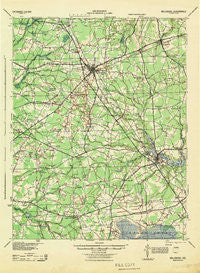
~ Millsboro DE topo map, 1:62500 scale, 15 X 15 Minute, Historical, 1944
Millsboro, Delaware, USGS topographic map dated 1944.
Includes geographic coordinates (latitude and longitude). This topographic map is suitable for hiking, camping, and exploring, or framing it as a wall map.
Printed on-demand using high resolution imagery, on heavy weight and acid free paper, or alternatively on a variety of synthetic materials.
Topos available on paper, Waterproof, Poly, or Tyvek. Usually shipping rolled, unless combined with other folded maps in one order.
- Product Number: USGS-5390330
- Free digital map download (high-resolution, GeoPDF): Millsboro, Delaware (file size: 7 MB)
- Map Size: please refer to the dimensions of the GeoPDF map above
- Weight (paper map): ca. 55 grams
- Map Type: POD USGS Topographic Map
- Map Series: HTMC
- Map Verison: Historical
- Cell ID: 57673
- Scan ID: 255766
- Woodland Tint: Yes
- Aerial Photo Year: 1938
- Survey Year: 1917
- Datum: Unstated
- Map Projection: Unstated
- Map published by United States Army Corps of Engineers
- Map published by United States Army
- Map published by United States Department of War
- Map Language: English
- Scanner Resolution: 600 dpi
- Map Cell Name: Millsboro
- Grid size: 15 X 15 Minute
- Date on map: 1944
- Map Scale: 1:62500
- Geographical region: Delaware, United States
Neighboring Maps:
All neighboring USGS topo maps are available for sale online at a variety of scales.
Spatial coverage:
Topo map Millsboro, Delaware, covers the geographical area associated the following places:
- Highland Terrace - Andersons Corner - Redden Crossroads - Nentego Manor - Cool Spring Farms - Cross Keys - Patterson Place Mobile Home Park - Flea Hill - Lakeview Estates - Whaleys Corners - Lazy Lake - Pine Lodge Addition - Dogwood Park Mobile Home Park - Old Landing - Evans Park Mobile Home Park - Holly Leaf Estates Mobile Home Park - Country Living Mobile Home Park - Burton Acres - Holiday Acres - Sand Hill - Gravel Hill - Piney Grove - Forest Park Mobile Home Park - Briarwood Manor - Mission - Harlemtown - Kings Crossroads - Dunbarton Oaks Apartments - Edward Cordrey Subdivision - Jones Crossroads - Greenlea Acres - Zoar - Gran-ville - Swain Acres - Morris Mill - Bryans Store - Rogers Development - Millsboro - Bennum - Springfield Crossroads - Harbeson - Piney Grove Manor - Shaft Ox Corner - Wood Branch - Knowles Crossroads - Lowes Crossroads - Pusey Crossroads - Homestead Mobile Home Park - Woodcrest Estates - Cool Spring Manor - White Horse Farm - Kings Second Addition - Sycamore - Pepper - Redden - Kerseys Evergreen Acres - Hitchens Crossroads - Sandy Beach - Gum Crossroads - County Seat Gardens Mobile Home Park - Hickory Hill - Oak Drive - Shortly - Riverview - Holiday Estates - Kawan Acres - Saulsbury Switch - Deerwood - Phillips Hill - Murrays Development - Stockley - Avalon Park Mobile Home Park - Georgetown - Shady Rest Park - McDonalds Crossroads - Fish Hook Mobile Home Court - Careys Estate Mobile Home Park - Springfield Farms Addition - Bowdens Garage (historical) - Mount Joy - Whaleys Crossroads - Hardscrabble - Larence Cordrey Subdivision - Pine Lake Development
- Map Area ID: AREA38.7538.5-75.5-75.25
- Northwest corner Lat/Long code: USGSNW38.75-75.5
- Northeast corner Lat/Long code: USGSNE38.75-75.25
- Southwest corner Lat/Long code: USGSSW38.5-75.5
- Southeast corner Lat/Long code: USGSSE38.5-75.25
- Northern map edge Latitude: 38.75
- Southern map edge Latitude: 38.5
- Western map edge Longitude: -75.5
- Eastern map edge Longitude: -75.25


