
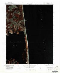
~ Rehoboth Beach DE topo map, 1:25000 scale, 7.5 X 7.5 Minute, Historical, 1980, updated 1982
Rehoboth Beach, Delaware, USGS topographic map dated 1980.
Includes geographic coordinates (latitude and longitude). This topographic map is suitable for hiking, camping, and exploring, or framing it as a wall map.
Printed on-demand using high resolution imagery, on heavy weight and acid free paper, or alternatively on a variety of synthetic materials.
Topos available on paper, Waterproof, Poly, or Tyvek. Usually shipping rolled, unless combined with other folded maps in one order.
- Product Number: USGS-5390286
- Free digital map download (high-resolution, GeoPDF): Rehoboth Beach, Delaware (file size: 7 MB)
- Map Size: please refer to the dimensions of the GeoPDF map above
- Weight (paper map): ca. 55 grams
- Map Type: POD USGS Topographic Map
- Map Series: HTMC
- Map Verison: Historical
- Cell ID: 37563
- Scan ID: 255634
- Imprint Year: 1982
- Aerial Photo Year: 1980
- Datum: NAD27
- Map Projection: Universal Transverse Mercator
- Orthophoto: Quad
- Map published by United States Geological Survey
- Map Language: English
- Scanner Resolution: 600 dpi
- Map Cell Name: Rehoboth Beach
- Grid size: 7.5 X 7.5 Minute
- Date on map: 1980
- Map Scale: 1:25000
- Geographical region: Delaware, United States
Neighboring Maps:
All neighboring USGS topo maps are available for sale online at a variety of scales.
Spatial coverage:
Topo map Rehoboth Beach, Delaware, covers the geographical area associated the following places:
- Indian Beach - Rehoboth Manor - Henlopen Keys - Camelot Mobile Home Park - Shockley Manor - Sea Air Mobile Home Park - Dodds Addition - Fishermans Park Mobile Home Park - Silver Lake Shores - Rehoboth Beach - Lingo Landing - Three Seasons Mobile Home Park - Henlopen Acres - Anne Acres - Spring Lake - Shady Ridge - Phil Mar Estates - Shady Grove - Bay Vista - Silver View Farm - Beachfield - West Rehoboth - Bald Eagle Village - North Shores - The Glade - Bay Harbor - Killens Addition - Indian Landing North Mobile Home Park - Seabreeze - Massey Landing - Shockley Heights - Truitts Park - Silver Lake Manor - Piney Glade - Washington Heights - Tru Vale Acres - Fieldwood Addition - Dewey Beach
- Map Area ID: AREA38.7538.625-75.125-75
- Northwest corner Lat/Long code: USGSNW38.75-75.125
- Northeast corner Lat/Long code: USGSNE38.75-75
- Southwest corner Lat/Long code: USGSSW38.625-75.125
- Southeast corner Lat/Long code: USGSSE38.625-75
- Northern map edge Latitude: 38.75
- Southern map edge Latitude: 38.625
- Western map edge Longitude: -75.125
- Eastern map edge Longitude: -75


