
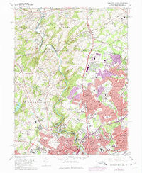
~ Wilmington North DE topo map, 1:24000 scale, 7.5 X 7.5 Minute, Historical, 1967, updated 1975
Wilmington North, Delaware, USGS topographic map dated 1967.
Includes geographic coordinates (latitude and longitude). This topographic map is suitable for hiking, camping, and exploring, or framing it as a wall map.
Printed on-demand using high resolution imagery, on heavy weight and acid free paper, or alternatively on a variety of synthetic materials.
Topos available on paper, Waterproof, Poly, or Tyvek. Usually shipping rolled, unless combined with other folded maps in one order.
- Product Number: USGS-5390240
- Free digital map download (high-resolution, GeoPDF): Wilmington North, Delaware (file size: 17 MB)
- Map Size: please refer to the dimensions of the GeoPDF map above
- Weight (paper map): ca. 55 grams
- Map Type: POD USGS Topographic Map
- Map Series: HTMC
- Map Verison: Historical
- Cell ID: 49297
- Scan ID: 255684
- Imprint Year: 1975
- Woodland Tint: Yes
- Photo Revision Year: 1973
- Aerial Photo Year: 1973
- Field Check Year: 1967
- Survey Year: 1936
- Datum: NAD27
- Map Projection: Polyconic
- Map published by United States Geological Survey
- Map Language: English
- Scanner Resolution: 600 dpi
- Map Cell Name: Wilmington North
- Grid size: 7.5 X 7.5 Minute
- Date on map: 1967
- Map Scale: 1:24000
- Geographical region: Delaware, United States
Neighboring Maps:
All neighboring USGS topo maps are available for sale online at a variety of scales.
Spatial coverage:
Topo map Wilmington North, Delaware, covers the geographical area associated the following places:
- Sharpley - Chapelcrest - Cossart Creek - Shipley Ridge - Windsor Hills - Mayfield - Weldin Park - Arborlea - Cossart Creek - Pennington - Cossart - North Hills - Ringfield - Chadds Ford - Wilmont - Kershaw Acres - Nanticoke Farms - Calais Woods - Barkley - Talley Brook - Kimberly Chase - Madelyn Gardens - Forwood - Carrcroft - Heatherbrooke - Centreville Tract - Longwood - Twin Oaks - Wickwood - Blue Rock Manor - Pembrey - Beacon Hill North - Brandywine Hills - Ways Corner - Wynleigh - Woodbine - Brandywine Perry Park - Chadds Ford Junction - Montchan - Edenridge - Hillcrest - Concord Manor - West Park - Chadds Ford Knoll - Devonshire - Rockland Woods - Naamans Manor - Pierson Farms - Concord - Pennyhill - Weber Tract - Weldin Farms - Wynnewood - Phillips Heights - Ridgewood - Norway - Webster Farm - Kentmere - Wexford Chapelcroft - Village of Rocky Run - Galewood - Glenside Farms - Fairfax Farms - Concord Crossing - Brandywine Commons - Brandywine - Blue Ball - Woodbrook - Delwoods - Lancaster Court - Granogue - Graylyn Crest - Twin Turns Farm - Augustine Hills - Normandy Manor - Foulk Woods - Smithfield Estates - Greenville Development - Greenville Place - Gristmill Woods - High Point - Talleyville - Chatham - The Ridings of Chadds Ford - Winterset Farms - Henry Clay - Perth - Rock Manor - Queonemysing (historical) - Club Lane - West Farm - Cardiff - Wawaset Park - Greenville Manor - Deerbrook II - Sedgley Farms - Hollingsworth Development - Williamhurst - Greenville - Benton
- Map Area ID: AREA39.87539.75-75.625-75.5
- Northwest corner Lat/Long code: USGSNW39.875-75.625
- Northeast corner Lat/Long code: USGSNE39.875-75.5
- Southwest corner Lat/Long code: USGSSW39.75-75.625
- Southeast corner Lat/Long code: USGSSE39.75-75.5
- Northern map edge Latitude: 39.875
- Southern map edge Latitude: 39.75
- Western map edge Longitude: -75.625
- Eastern map edge Longitude: -75.5


