
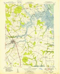
~ Smyrna DE topo map, 1:24000 scale, 7.5 X 7.5 Minute, Historical, 1949
Smyrna, Delaware, USGS topographic map dated 1949.
Includes geographic coordinates (latitude and longitude). This topographic map is suitable for hiking, camping, and exploring, or framing it as a wall map.
Printed on-demand using high resolution imagery, on heavy weight and acid free paper, or alternatively on a variety of synthetic materials.
Topos available on paper, Waterproof, Poly, or Tyvek. Usually shipping rolled, unless combined with other folded maps in one order.
- Product Number: USGS-5390202
- Free digital map download (high-resolution, GeoPDF): Smyrna, Delaware (file size: 10 MB)
- Map Size: please refer to the dimensions of the GeoPDF map above
- Weight (paper map): ca. 55 grams
- Map Type: POD USGS Topographic Map
- Map Series: HTMC
- Map Verison: Historical
- Cell ID: 41848
- Scan ID: 255660
- Woodland Tint: Yes
- Aerial Photo Year: 1946
- Survey Year: 1947
- Datum: NAD27
- Map Projection: Polyconic
- Map published by United States Department of Commerce
- Map Language: English
- Scanner Resolution: 600 dpi
- Map Cell Name: Smyrna
- Grid size: 7.5 X 7.5 Minute
- Date on map: 1949
- Map Scale: 1:24000
- Geographical region: Delaware, United States
Neighboring Maps:
All neighboring USGS topo maps are available for sale online at a variety of scales.
Spatial coverage:
Topo map Smyrna, Delaware, covers the geographical area associated the following places:
- Eagles Nest Landing - Brick Store - Bombay Woods - Maplehurst - Taylors Gut Landing - Flemings Landing - Hedgerow Hollow Mobile Home Park - Windy Way - Millcreek - Hickory Ridge - Sunnyside Acres - Big Oak Corners - Colmar Manor - Woodland Court Mobile Home Park - Shorts Landing - Mallards Run - Ravenwood - Village of Garrison Lake - Spruance City - Whitehall Crossroads - Commerce Square - Dutch Neck Crossroads - Lawndale - Gardenside - Hay Point Landing - Chambersville - Deakyneville - Ridgewood Manor - Duck Creek Landing - Nandains Landing - Smyrna - Burtonwood Village - Sunnyside Village - Walker - West Shore - Long Point Landing - Cedarbrook Acres - Brenford - Tent - Smyrna Landing - Sheriden
- Map Area ID: AREA39.37539.25-75.625-75.5
- Northwest corner Lat/Long code: USGSNW39.375-75.625
- Northeast corner Lat/Long code: USGSNE39.375-75.5
- Southwest corner Lat/Long code: USGSSW39.25-75.625
- Southeast corner Lat/Long code: USGSSE39.25-75.5
- Northern map edge Latitude: 39.375
- Southern map edge Latitude: 39.25
- Western map edge Longitude: -75.625
- Eastern map edge Longitude: -75.5


