
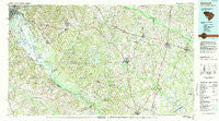
~ Barnwell SC topo map, 1:100000 scale, 30 X 60 Minute, Historical, 1982, updated 1984
Barnwell, South Carolina, USGS topographic map dated 1982.
Includes geographic coordinates (latitude and longitude). This topographic map is suitable for hiking, camping, and exploring, or framing it as a wall map.
Printed on-demand using high resolution imagery, on heavy weight and acid free paper, or alternatively on a variety of synthetic materials.
Topos available on paper, Waterproof, Poly, or Tyvek. Usually shipping rolled, unless combined with other folded maps in one order.
- Product Number: USGS-5389050
- Free digital map download (high-resolution, GeoPDF): Barnwell, South Carolina (file size: 31 MB)
- Map Size: please refer to the dimensions of the GeoPDF map above
- Weight (paper map): ca. 55 grams
- Map Type: POD USGS Topographic Map
- Map Series: HTMC
- Map Verison: Historical
- Cell ID: 67097
- Scan ID: 261995
- Imprint Year: 1984
- Woodland Tint: Yes
- Aerial Photo Year: 1981
- Edit Year: 1982
- Datum: NAD27
- Map Projection: Universal Transverse Mercator
- Map published by United States Geological Survey
- Map Language: English
- Scanner Resolution: 600 dpi
- Map Cell Name: Barnwell
- Grid size: 30 X 60 Minute
- Date on map: 1982
- Map Scale: 1:100000
- Geographical region: South Carolina, United States
Neighboring Maps:
All neighboring USGS topo maps are available for sale online at a variety of scales.
Spatial coverage:
Topo map Barnwell, South Carolina, covers the geographical area associated the following places:
- Eastview - Olar - Augusta - Walkinshaw - Shell Bluff - Storm Branch Park - Chukker Creek - Norway - Springfield - Snelling - Ashleigh - Sycamore - Dunbarton (historical) - Schultz Hill - Russell Hill - Tuten (historical) - Brigham Woods - Girard - Govan - Shell Bluff Landing - Hyde Park - Barnwell - Browns Hill - Hills Store - Clearwater - Asbury (historical) - Talatha - Hattieville - Lees - Williston - Ashley Place (historical) - Brookhaven Estates - Grays Crossroads - Kathwood - Loraine (historical) - Appleton - Beech Island - Allendale - Edisto Club - Spring Branch (historical) - Savannah Terrace - Farrells Mill - Schofield - Whaley - Kline - Johnson Crossroads - Greenland (historical) - Jackson - Hankinson - Apple Valley - Summerfields - Talatha Farms - Boiling Springs - Idlewood - Mechanic Hill - Blackville - McBean - Owens Crossroad - Spiderweb - Seigling - Westover - Hamburg - Marion Homes - Cowden - Ehrhardt - College Acres - Robbins (historical) - Fogles (historical) - Windsor - Clear Pond - Oak Hill - New Ellenton - Waynor (historical) - Ott (historical) - Goshen Plantation - Garris (historical) - Happy Bottom - White Pond - Healing Springs - Lynns Ranchettes - Donora (historical) - Twiggs - Stone Gap - Thomas Station - Aragon Park - Old Church - Creco (historical) - Hayes Crossroads - Rosemary (historical) - Johnstown - Bolen Town - Luther (historical) - Savanna Town (historical) - Sunset Heights - Grays Landing - Hunters Glen - Sato - Hells Half Acre - Ellenton (historical) - Averill
- Map Area ID: AREA33.533-82-81
- Northwest corner Lat/Long code: USGSNW33.5-82
- Northeast corner Lat/Long code: USGSNE33.5-81
- Southwest corner Lat/Long code: USGSSW33-82
- Southeast corner Lat/Long code: USGSSE33-81
- Northern map edge Latitude: 33.5
- Southern map edge Latitude: 33
- Western map edge Longitude: -82
- Eastern map edge Longitude: -81


