
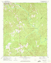
~ Whitmire South SC topo map, 1:24000 scale, 7.5 X 7.5 Minute, Historical, 1969, updated 1972
Whitmire South, South Carolina, USGS topographic map dated 1969.
Includes geographic coordinates (latitude and longitude). This topographic map is suitable for hiking, camping, and exploring, or framing it as a wall map.
Printed on-demand using high resolution imagery, on heavy weight and acid free paper, or alternatively on a variety of synthetic materials.
Topos available on paper, Waterproof, Poly, or Tyvek. Usually shipping rolled, unless combined with other folded maps in one order.
- Product Number: USGS-5388554
- Free digital map download (high-resolution, GeoPDF): Whitmire South, South Carolina (file size: 13 MB)
- Map Size: please refer to the dimensions of the GeoPDF map above
- Weight (paper map): ca. 55 grams
- Map Type: POD USGS Topographic Map
- Map Series: HTMC
- Map Verison: Historical
- Cell ID: 48903
- Scan ID: 261717
- Imprint Year: 1972
- Woodland Tint: Yes
- Aerial Photo Year: 1966
- Field Check Year: 1969
- Datum: NAD27
- Map Projection: Polyconic
- Map published by United States Geological Survey
- Map Language: English
- Scanner Resolution: 600 dpi
- Map Cell Name: Whitmire South
- Grid size: 7.5 X 7.5 Minute
- Date on map: 1969
- Map Scale: 1:24000
- Geographical region: South Carolina, United States
Neighboring Maps:
All neighboring USGS topo maps are available for sale online at a variety of scales.
Spatial coverage:
Topo map Whitmire South, South Carolina, covers the geographical area associated the following places:
- Long Lane Lookout Tower - Wilsons Creek - Laway School (historical) - McCollough Church - Indian Creek Work Center - Hunting Creek - McCullough School (historical) - Fosters Branch - Kings Creek School (historical) - Duncan Creek - New Hope Cemetery - Kings Creek Church - Indian Creek - Means Branch - Sulphur Spring Branch - First Church of God - Renwick Grove Church - Gilders Creek - South Fork Kings Creek - Long Lane Hunt Camp - Avery Ford - Brazzlemans Bridge - Douglas School (historical) - Collins Creek Hunt Camp - Willow Oak Hunt Camp - Kings Creek Cemetery - New Hope Church - Long Lane - Pattersons Creek - Collins Branch - Asias Branch - Long Lane School (historical) - Whitmire Division - Mollyhorn School (historical) - Little Kings Creek - Long Lane Branch School (historical) - Indian Creek Rifle Range - Colonel Brown School (historical) - Horseshoe Bend - Mollys Rock Recreation Area - Saint Pauls Church (historical) - Bakers Cross Roads - Pentecostal Holiness Church - Enoree Ranger District Office - Civilian Conservation Corps Camp F-6 (historical) - Kings Creek
- Map Area ID: AREA34.534.375-81.625-81.5
- Northwest corner Lat/Long code: USGSNW34.5-81.625
- Northeast corner Lat/Long code: USGSNE34.5-81.5
- Southwest corner Lat/Long code: USGSSW34.375-81.625
- Southeast corner Lat/Long code: USGSSE34.375-81.5
- Northern map edge Latitude: 34.5
- Southern map edge Latitude: 34.375
- Western map edge Longitude: -81.625
- Eastern map edge Longitude: -81.5


