
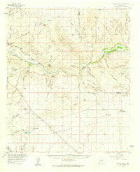
~ Canador Peak NM topo map, 1:62500 scale, 15 X 15 Minute, Historical, 1959, updated 1960
Canador Peak, New Mexico, USGS topographic map dated 1959.
Includes geographic coordinates (latitude and longitude). This topographic map is suitable for hiking, camping, and exploring, or framing it as a wall map.
Printed on-demand using high resolution imagery, on heavy weight and acid free paper, or alternatively on a variety of synthetic materials.
Topos available on paper, Waterproof, Poly, or Tyvek. Usually shipping rolled, unless combined with other folded maps in one order.
- Product Number: USGS-5385366
- Free digital map download (high-resolution, GeoPDF): Canador Peak, New Mexico (file size: 6 MB)
- Map Size: please refer to the dimensions of the GeoPDF map above
- Weight (paper map): ca. 55 grams
- Map Type: POD USGS Topographic Map
- Map Series: HTMC
- Map Verison: Historical
- Cell ID: 52075
- Scan ID: 189945
- Imprint Year: 1960
- Woodland Tint: Yes
- Aerial Photo Year: 1957
- Field Check Year: 1959
- Datum: NAD27
- Map Projection: Polyconic
- Map published by United States Geological Survey
- Map Language: English
- Scanner Resolution: 600 dpi
- Map Cell Name: Canador Peak
- Grid size: 15 X 15 Minute
- Date on map: 1959
- Map Scale: 1:62500
- Geographical region: New Mexico, United States
Neighboring Maps:
All neighboring USGS topo maps are available for sale online at a variety of scales.
Spatial coverage:
Topo map Canador Peak, New Mexico, covers the geographical area associated the following places:
- Lone Mountain - Anderson Windmill - Black Hills - White Rock Canyon - Mexican Springs - Box Canyon - Sunset Canal - Hill Canyon - Burtch Windmill - Cliff Roy Mine - Caprock Mountain - Johns Canyon - Summit Hills - Cliff Roy - Riley Peaks - Cottonwood Canyon - McHaffey Windmill - West Fork Windham Canyon - Caprock Prong - Bar U Windmill - Steeple Rock Canyon - Picnic Canyon - Riley Spring - Cottonwood Spring - Gila Lower Box - Corral Canyon - East Fork Windham Canyon - Riley Canyon - Harris Canyon - North Fork Corral Canyon - Gila Bend - Elliot Canyon - Canador Peak Windmill - Baldy Hill - South Fork Corral Canyon - Blue Creek - Z Bar L Windmill - Red Hill - Lordsburg Mesa - Rock Tank - Rock Tank Draw - Black Bob Group Mine - Tank Number Two - Hughs Canyon - L C Canyon - Mexican Canyon - Canador Peak - Winnie Claim - Tank Number 1 - Raymond Fuller Ranch - Nichols Canyon - Remington Lode - Box Canyon Windmill - Secho Detention Dam - Gila Lower Box Wilderness Study Area - Backer Ranch - Cottonwood Windmill - Deadman Ridge - Willow Draw - Tank Draw - Blue Creek Wilderness Study Area - Moore Box - Davenport Canyon - Black Bob Mine - Nichols Spring - Harper Windmill - Mesa Tank - Consolation Mine - Fuller Ranch - Poe Mine - Rimrock - Black Mountain - Stanford Detention Dam Number Two - 10002 Water Well - Pearson Mesa - Wilson Mine - Stanford Detention Dam Number Three - White Rock Canyon - Seep Spring Draw - Constellation Mine
- Map Area ID: AREA32.7532.5-109-108.75
- Northwest corner Lat/Long code: USGSNW32.75-109
- Northeast corner Lat/Long code: USGSNE32.75-108.75
- Southwest corner Lat/Long code: USGSSW32.5-109
- Southeast corner Lat/Long code: USGSSE32.5-108.75
- Northern map edge Latitude: 32.75
- Southern map edge Latitude: 32.5
- Western map edge Longitude: -109
- Eastern map edge Longitude: -108.75


