
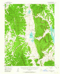
~ Boulder Lake NM topo map, 1:62500 scale, 15 X 15 Minute, Historical, 1955, updated 1963
Boulder Lake, New Mexico, USGS topographic map dated 1955.
Includes geographic coordinates (latitude and longitude). This topographic map is suitable for hiking, camping, and exploring, or framing it as a wall map.
Printed on-demand using high resolution imagery, on heavy weight and acid free paper, or alternatively on a variety of synthetic materials.
Topos available on paper, Waterproof, Poly, or Tyvek. Usually shipping rolled, unless combined with other folded maps in one order.
- Product Number: USGS-5385336
- Free digital map download (high-resolution, GeoPDF): Boulder Lake, New Mexico (file size: 9 MB)
- Map Size: please refer to the dimensions of the GeoPDF map above
- Weight (paper map): ca. 55 grams
- Map Type: POD USGS Topographic Map
- Map Series: HTMC
- Map Verison: Historical
- Cell ID: 51670
- Scan ID: 189853
- Imprint Year: 1963
- Woodland Tint: Yes
- Aerial Photo Year: 1952
- Field Check Year: 1955
- Datum: NAD27
- Map Projection: Polyconic
- Map published by United States Geological Survey
- Map Language: English
- Scanner Resolution: 600 dpi
- Map Cell Name: Boulder Lake
- Grid size: 15 X 15 Minute
- Date on map: 1955
- Map Scale: 1:62500
- Geographical region: New Mexico, United States
Neighboring Maps:
All neighboring USGS topo maps are available for sale online at a variety of scales.
Spatial coverage:
Topo map Boulder Lake, New Mexico, covers the geographical area associated the following places:
- La Puerta Grande - Stock Driveway Canyon - Arroyo Archuleta - Pound Ranch - Hayden Lake Dam - Cedar Spring - Cedar Canyon - Boulder Creek - Stone Lake Dike Number Two - Pounds Mesa - El Vado Reservoir - Railroad Canyon - Stone Lake Dike Number Four - Horse Island - Ojitos Tank - Stone Lake Dike Number Three - Puerto Chiquito - Apache Mesa - Cedar Springs Lookout - Puerto Chiquito - Stone Lake Lodge - Timber Lake - Dipping Vat Tank - Thompson Lake - Stinking Lake - Stone Lake Dike Number One - Cisneros Canyon - Tapia Tank - Stone Lake Dam - Boundary Tank - Hayden Lake - Los Indios Canyon - Stone Lake - Burford Lake Wildlife Station - Pump House Canyon - La Jara Lake
- Map Area ID: AREA36.7536.5-107-106.75
- Northwest corner Lat/Long code: USGSNW36.75-107
- Northeast corner Lat/Long code: USGSNE36.75-106.75
- Southwest corner Lat/Long code: USGSSW36.5-107
- Southeast corner Lat/Long code: USGSSE36.5-106.75
- Northern map edge Latitude: 36.75
- Southern map edge Latitude: 36.5
- Western map edge Longitude: -107
- Eastern map edge Longitude: -106.75


