
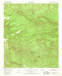
~ Reading Mountain NM topo map, 1:24000 scale, 7.5 X 7.5 Minute, Historical, 1950, updated 1969
Reading Mountain, New Mexico, USGS topographic map dated 1950.
Includes geographic coordinates (latitude and longitude). This topographic map is suitable for hiking, camping, and exploring, or framing it as a wall map.
Printed on-demand using high resolution imagery, on heavy weight and acid free paper, or alternatively on a variety of synthetic materials.
Topos available on paper, Waterproof, Poly, or Tyvek. Usually shipping rolled, unless combined with other folded maps in one order.
- Product Number: USGS-5383141
- Free digital map download (high-resolution, GeoPDF): Reading Mountain, New Mexico (file size: 15 MB)
- Map Size: please refer to the dimensions of the GeoPDF map above
- Weight (paper map): ca. 55 grams
- Map Type: POD USGS Topographic Map
- Map Series: HTMC
- Map Verison: Historical
- Cell ID: 37246
- Scan ID: 192041
- Imprint Year: 1969
- Woodland Tint: Yes
- Aerial Photo Year: 1945
- Field Check Year: 1950
- Datum: NAD27
- Map Projection: Polyconic
- Map published by United States Geological Survey
- Map Language: English
- Scanner Resolution: 600 dpi
- Map Cell Name: Reading Mountain
- Grid size: 7.5 X 7.5 Minute
- Date on map: 1950
- Map Scale: 1:24000
- Geographical region: New Mexico, United States
Neighboring Maps:
All neighboring USGS topo maps are available for sale online at a variety of scales.
Spatial coverage:
Topo map Reading Mountain, New Mexico, covers the geographical area associated the following places:
- Turkey Flat - Cooley Tank - Long Gulch - Cooley Spring - Goat Canyon - Codey Tank - Clark Spring - Sawmill Spring - Little Pipeline Spring - Cherry Creek Canyon - Lower Cave Creek Spring - Sycamore Creek - Walnut Creek - Turkey Canyon - Moore Canyon - Little Pipe Spring - Bobtail Mesa - Pipeline Spring - Snow Creek Spring - Webb Gulch - Preachers Point - Big Trap Spring - Pipeline Spring - Cherry Creek - A Four Mountain - Cave Spring - Reading Mesa - Homon Spring - Snow Creek Tank - Devils Garden - Arroyo Rico - Holmon Spring - Snow Creek Trail - Moore Spring - Tadpole Ridge - Hells Canyon Spring - Hidden Spring - Salt Mesa Spring - Upper Cave Creek Spring - Cave Canyon - Juniper Hill - Salt Mesa Spring - Walnut Creek Spring - Allen Spring - Snow Creek Cabin - Cave Spring Canyon - Horseshoe Bend - Bear Creek Spring - North Fork Walnut Creek - Quartzite Tank - Holman Spring - Wilson Creek - Sycamore Spring - Reading Mountain - Moore Tank - Buckwood Mesa - Salt Mesa - Tadpole Lake - Fenceline Spring - Pipeline Spring
- Map Area ID: AREA3332.875-108.375-108.25
- Northwest corner Lat/Long code: USGSNW33-108.375
- Northeast corner Lat/Long code: USGSNE33-108.25
- Southwest corner Lat/Long code: USGSSW32.875-108.375
- Southeast corner Lat/Long code: USGSSE32.875-108.25
- Northern map edge Latitude: 33
- Southern map edge Latitude: 32.875
- Western map edge Longitude: -108.375
- Eastern map edge Longitude: -108.25


