
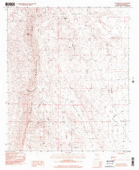
~ Palomas Gap NM topo map, 1:24000 scale, 7.5 X 7.5 Minute, Historical, 1996, updated 2002
Palomas Gap, New Mexico, USGS topographic map dated 1996.
Includes geographic coordinates (latitude and longitude). This topographic map is suitable for hiking, camping, and exploring, or framing it as a wall map.
Printed on-demand using high resolution imagery, on heavy weight and acid free paper, or alternatively on a variety of synthetic materials.
Topos available on paper, Waterproof, Poly, or Tyvek. Usually shipping rolled, unless combined with other folded maps in one order.
- Product Number: USGS-5382663
- Free digital map download (high-resolution, GeoPDF): Palomas Gap, New Mexico (file size: 11 MB)
- Map Size: please refer to the dimensions of the GeoPDF map above
- Weight (paper map): ca. 55 grams
- Map Type: POD USGS Topographic Map
- Map Series: HTMC
- Map Verison: Historical
- Cell ID: 34047
- Scan ID: 194150
- Imprint Year: 2002
- Photo Inspection Year: 1996
- Aerial Photo Year: 1978
- Edit Year: 2001
- Field Check Year: 1980
- Datum: NAD27
- Map Projection: Transverse Mercator
- Provisional map: Yes
- Map published by United States Geological Survey
- Map Language: English
- Scanner Resolution: 600 dpi
- Map Cell Name: Palomas Gap
- Grid size: 7.5 X 7.5 Minute
- Date on map: 1996
- Map Scale: 1:24000
- Geographical region: New Mexico, United States
Neighboring Maps:
All neighboring USGS topo maps are available for sale online at a variety of scales.
Spatial coverage:
Topo map Palomas Gap, New Mexico, covers the geographical area associated the following places:
- Carroll - Palomas Gap - Napolean- Rosa Lee Group - Little Johnnie Mine - Blue Jacket Prospect - Tingley Prospect - Little Ohmey Tank - Mescal Spring - Dewey - Oakland Vein Mine - Bootlegger Windmill - Independence Mine - Lincoln Mine - Palomas Gap Creek - Parker Windmill - Yellowjacket Mine Number 1 - Red Tank - Cox - Tingley - Oohoo - Caballo Cone - Marian Mine - Ash Spring - Riverside Mine - Lone Tree Prospect - Wild Horse - Cox Mine - Universal Mine - White Swan - Marian Mine - Governor - Forty-One Claim - Illinois - Carroll Prospect - Victoria Mine - Caballo Spring Windmill - Little Johnnie Mine - Black Jack Mine - Yellowjacket Mine Number 2 - Lead Mine Canyon - Barney Lorio Number 1 Spring - Caballo Canyon - Forty-One and Riverside Mine - Napoleon - Rosa Lee - Carolyn - Ashland Mine - Dewey and White Swan Deposit - White Star Vein Mine - Turtle Mountain - Hadley Canyon - Harding - Dakota Mine - Red Top
- Map Area ID: AREA33.12533-107.25-107.125
- Northwest corner Lat/Long code: USGSNW33.125-107.25
- Northeast corner Lat/Long code: USGSNE33.125-107.125
- Southwest corner Lat/Long code: USGSSW33-107.25
- Southeast corner Lat/Long code: USGSSE33-107.125
- Northern map edge Latitude: 33.125
- Southern map edge Latitude: 33
- Western map edge Longitude: -107.25
- Eastern map edge Longitude: -107.125


