
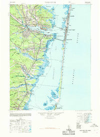
~ Toms River NJ topo map, 1:62500 scale, 15 X 15 Minute, Historical, 1948, updated 1969
Toms River, New Jersey, USGS topographic map dated 1948.
Includes geographic coordinates (latitude and longitude). This topographic map is suitable for hiking, camping, and exploring, or framing it as a wall map.
Printed on-demand using high resolution imagery, on heavy weight and acid free paper, or alternatively on a variety of synthetic materials.
Topos available on paper, Waterproof, Poly, or Tyvek. Usually shipping rolled, unless combined with other folded maps in one order.
- Product Number: USGS-5377572
- Free digital map download (high-resolution, GeoPDF): Toms River, New Jersey (file size: 8 MB)
- Map Size: please refer to the dimensions of the GeoPDF map above
- Weight (paper map): ca. 55 grams
- Map Type: POD USGS Topographic Map
- Map Series: HTMC
- Map Verison: Historical
- Cell ID: 63620
- Scan ID: 255403
- Imprint Year: 1969
- Woodland Tint: Yes
- Aerial Photo Year: 1940
- Edit Year: 1946
- Datum: NAD27
- Map Projection: Transverse Mercator
- Map published by United States Army
- Map Language: English
- Scanner Resolution: 600 dpi
- Map Cell Name: Toms River
- Grid size: 15 X 15 Minute
- Date on map: 1948
- Map Scale: 1:62500
- Geographical region: New Jersey, United States
Neighboring Maps:
All neighboring USGS topo maps are available for sale online at a variety of scales.
Spatial coverage:
Topo map Toms River, New Jersey, covers the geographical area associated the following places:
- Ocean Beach - Deer Chase Manor - Pine Beach - Murray Grove - Barnegat - South Seaside Park - Island Heights - Barnegat Light - Toms River - Forked River Beach - Chadwick Beach - Camelot - Seaside Park - Suburban Park - Forked River Point - Chadwick - Ortley Terrace - Parkway Manor - Silver Beach - Monterey Beach - Crystal Lake - Silver Ridge Park - Dover Beaches North - Greenwood Manor - Colonial Gardens - Holly Park - Island Beach Heights - Rivercrest Manor - Bayville - Hilltop Estates - Laurel Harbor - Lavallette - Gilford Park - Cedar Beach - Beachwood - Waretown - Lanoka Harbor - Windor Park - Pinewald - Pebble Beach - Brookside Heights - Windsor Park - Ortley Beach - Oak Ridge Estates - Forest Acres - Oak Glen - Seaside Heights - Riverview Estates - River Bank - Silver Ridge - Barnegat Bay Estates - Sunrise Beach - Double Trouble - Sky View Manor - Oak Ridge - Forked River - Snug Harbor - Berkeley Shores - Bamberry Estates - Woodville - Bay Shore - Woodlawn Estates - Bayview Harbors - South Toms River - Bellcrest Park - Holiday Estates - Cranberry Hill - Barnegat Pines - Barnegat Bay - Cranmoor Manor - Seaside Heights Harbor - Dover Beaches South - Summit East - Maple Shade - Barnegat Beach - Fairview Estates - Wintringham Park - Holiday Beach - Cedar Grove - Manitou Park - Ocean Gate - Glen Cove - Bayside Beach - Riviera on the Barnegat
- Map Area ID: AREA4039.75-74.25-74
- Northwest corner Lat/Long code: USGSNW40-74.25
- Northeast corner Lat/Long code: USGSNE40-74
- Southwest corner Lat/Long code: USGSSW39.75-74.25
- Southeast corner Lat/Long code: USGSSE39.75-74
- Northern map edge Latitude: 40
- Southern map edge Latitude: 39.75
- Western map edge Longitude: -74.25
- Eastern map edge Longitude: -74


