
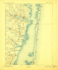
~ Barnegat NJ topo map, 1:62500 scale, 15 X 15 Minute, Historical, 1898, updated 1908
Barnegat, New Jersey, USGS topographic map dated 1898.
Includes geographic coordinates (latitude and longitude). This topographic map is suitable for hiking, camping, and exploring, or framing it as a wall map.
Printed on-demand using high resolution imagery, on heavy weight and acid free paper, or alternatively on a variety of synthetic materials.
Topos available on paper, Waterproof, Poly, or Tyvek. Usually shipping rolled, unless combined with other folded maps in one order.
- Product Number: USGS-5377070
- Free digital map download (high-resolution, GeoPDF): Barnegat, New Jersey (file size: 8 MB)
- Map Size: please refer to the dimensions of the GeoPDF map above
- Weight (paper map): ca. 55 grams
- Map Type: POD USGS Topographic Map
- Map Series: HTMC
- Map Verison: Historical
- Cell ID: 63620
- Scan ID: 255110
- Imprint Year: 1908
- Survey Year: 1884
- Datum: Unstated
- Map Projection: Unstated
- Map published by United States Geological Survey
- Map Language: English
- Scanner Resolution: 600 dpi
- Map Cell Name: Toms River
- Grid size: 15 X 15 Minute
- Date on map: 1898
- Map Scale: 1:62500
- Geographical region: New Jersey, United States
Neighboring Maps:
All neighboring USGS topo maps are available for sale online at a variety of scales.
Spatial coverage:
Topo map Barnegat, New Jersey, covers the geographical area associated the following places:
- Cedar Grove - Island Beach Heights - Cranmoor Manor - Forest Acres - South Toms River - Fairview Estates - Silver Ridge - Woodlawn Estates - Sunrise Beach - Oak Ridge Estates - Holiday Estates - Chadwick Beach - Oak Glen - Pebble Beach - Dover Beaches North - Pine Beach - Manitou Park - Bay Shore - Summit East - Ortley Terrace - Greenwood Manor - Parkway Manor - Forked River Point - Lavallette - Hilltop Estates - Suburban Park - River Bank - Toms River - Forked River - Bayside Beach - Pinewald - Chadwick - Camelot - Barnegat - Silver Beach - Barnegat Beach - Holly Park - Waretown - Ocean Gate - Bamberry Estates - Holiday Beach - Barnegat Bay - Ortley Beach - Silver Ridge Park - Deer Chase Manor - Riviera on the Barnegat - Seaside Heights - Berkeley Shores - Wintringham Park - Woodville - Barnegat Light - Forked River Beach - Island Heights - Double Trouble - Windsor Park - Snug Harbor - Murray Grove - Bayville - Cranberry Hill - Riverview Estates - Bayview Harbors - South Seaside Park - Barnegat Bay Estates - Lanoka Harbor - Beachwood - Oak Ridge - Glen Cove - Rivercrest Manor - Barnegat Pines - Sky View Manor - Monterey Beach - Cedar Beach - Dover Beaches South - Seaside Park - Maple Shade - Laurel Harbor - Gilford Park - Bellcrest Park - Ocean Beach - Crystal Lake - Colonial Gardens - Windor Park - Seaside Heights Harbor - Brookside Heights
- Map Area ID: AREA4039.75-74.25-74
- Northwest corner Lat/Long code: USGSNW40-74.25
- Northeast corner Lat/Long code: USGSNE40-74
- Southwest corner Lat/Long code: USGSSW39.75-74.25
- Southeast corner Lat/Long code: USGSSE39.75-74
- Northern map edge Latitude: 40
- Southern map edge Latitude: 39.75
- Western map edge Longitude: -74.25
- Eastern map edge Longitude: -74


