
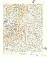
~ Saluda NC topo map, 1:125000 scale, 30 X 30 Minute, Historical, 1907, updated 1942
Saluda, North Carolina, USGS topographic map dated 1907.
Includes geographic coordinates (latitude and longitude). This topographic map is suitable for hiking, camping, and exploring, or framing it as a wall map.
Printed on-demand using high resolution imagery, on heavy weight and acid free paper, or alternatively on a variety of synthetic materials.
Topos available on paper, Waterproof, Poly, or Tyvek. Usually shipping rolled, unless combined with other folded maps in one order.
- Product Number: USGS-5374978
- Free digital map download (high-resolution, GeoPDF): Saluda, North Carolina (file size: 10 MB)
- Map Size: please refer to the dimensions of the GeoPDF map above
- Weight (paper map): ca. 55 grams
- Map Type: POD USGS Topographic Map
- Map Series: HTMC
- Map Verison: Historical
- Cell ID: 66534
- Scan ID: 164831
- Imprint Year: 1942
- Survey Year: 1905
- Datum: Unstated
- Map Projection: Polyconic
- Map published by United States Geological Survey
- Map Language: English
- Scanner Resolution: 600 dpi
- Map Cell Name: Saluda
- Grid size: 30 X 30 Minute
- Date on map: 1907
- Map Scale: 1:125000
- Geographical region: North Carolina, United States
Neighboring Maps:
All neighboring USGS topo maps are available for sale online at a variety of scales.
Spatial coverage:
Topo map Saluda, North Carolina, covers the geographical area associated the following places:
- Cox Store - Burnt Chimney Corner - Mack (historical) - Springdale - Golf Estates - Bat Cave - The Pines - Kenwood Knolls - Saluda - Melrose - Tidmans Place - Country Club Estates - Glenn Brook - Hickory Grove - Glassy - Overlook - Holly Springs - Wildwood Park (historical) - Chestnut Hill - Stearns - Fingerville - Riverbend - The Meadows - Valley Hill - Cumberland Village - Woodhaven - Laurel Rock Acres - Terrace Gardens - Maxwell Mill - Mountain View Mobile Home Park - Marydell (historical) - Peniel - Inman Mills - Cuba (historical) - Terry Creek - Laurel Park - Brookwood Trailer Park - Holly Hill - Chestnut Springs - Mill Spring - Cross Plains - North Ridge - Tyger (historical) - Highland - Five Points - Teneriffe - Deerfield - Ottanola - River Oaks - Carolina Village - Brannons Store (historical) - Gap Creek - Plantation Walk - Stoneycrest - Brown Arrow - Hickory Hills - Andover (historical) - Butt Mountain - Little Chicago - Campton - Mountain Page - Bellvue - Youngs Mountain - Cinnimon Woods - Druid Hills - Woodridge - Riverdale - Gaines Mobile Home Park - Landrum - Edneyville - Mount Valley - O'Neal - Locust Hill - Obed (historical) - Laurel Park Villas - Oak Hill - Shehan Crossroads (historical) - Mill Corner - Nanito (historical) - Shingle Hollow - Kingswood - Windor Hills - Beaumont - Blue Ridge - Woodfin - Clark Estates - North Pacolet - Echo Lakes - Goodluck - Lynn - Copper Ford - Inman - Lima - Grimesdale - Dodd Hill - Essex - Kanuga Pines - Gowensville - Fruitland - Stone Brook
- Map Area ID: AREA35.535-82.5-82
- Northwest corner Lat/Long code: USGSNW35.5-82.5
- Northeast corner Lat/Long code: USGSNE35.5-82
- Southwest corner Lat/Long code: USGSSW35-82.5
- Southeast corner Lat/Long code: USGSSE35-82
- Northern map edge Latitude: 35.5
- Southern map edge Latitude: 35
- Western map edge Longitude: -82.5
- Eastern map edge Longitude: -82


