
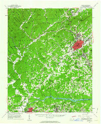
~ Lenoir NC topo map, 1:62500 scale, 15 X 15 Minute, Historical, 1956, updated 1963
Lenoir, North Carolina, USGS topographic map dated 1956.
Includes geographic coordinates (latitude and longitude). This topographic map is suitable for hiking, camping, and exploring, or framing it as a wall map.
Printed on-demand using high resolution imagery, on heavy weight and acid free paper, or alternatively on a variety of synthetic materials.
Topos available on paper, Waterproof, Poly, or Tyvek. Usually shipping rolled, unless combined with other folded maps in one order.
- Product Number: USGS-5374564
- Free digital map download (high-resolution, GeoPDF): Lenoir, North Carolina (file size: 10 MB)
- Map Size: please refer to the dimensions of the GeoPDF map above
- Weight (paper map): ca. 55 grams
- Map Type: POD USGS Topographic Map
- Map Series: HTMC
- Map Verison: Historical
- Cell ID: 56653
- Scan ID: 162850
- Imprint Year: 1963
- Woodland Tint: Yes
- Datum: NAD27
- Map Projection: Polyconic
- Map published by United States Geological Survey
- Map Language: English
- Scanner Resolution: 600 dpi
- Map Cell Name: Lenoir
- Grid size: 15 X 15 Minute
- Date on map: 1956
- Map Scale: 1:62500
- Geographical region: North Carolina, United States
Neighboring Maps:
All neighboring USGS topo maps are available for sale online at a variety of scales.
Spatial coverage:
Topo map Lenoir, North Carolina, covers the geographical area associated the following places:
- Baton - Muttenz (historical) - Pinehurst - Tranquil Hill - Queens Acres - Patterson - Spencer Heights - Valmead - Calico Place - Forest Hills - Adako - Grand View Park - Piedmont Park Subdivision - Gamewell Heights - Perkinsville - Town and Country - Lovelady (historical) - Tremont Park - Collins (historical) - Brown Mountain Beach - Rambling Acres - Chesterfield - Gamewell - Hampton Heights - Piney - Amherst - Honey Hill - Oakmont Estates - Corola Hills - Cloverdale - Whitnel - Heritage Hills - Lenoir - Olivette - Worry - Globe Set (historical) - Charlesmont - Cajahs Mountain - Hartland - Linville River (historical) - Copenhagen (historical) - Indian Hills - Warrior - Drexel - Johnson Development - Joyceton - Happy Valley - West Lenoir - Glenburine (historical) - Fairway Acres - Collettsville - Abingdon - Pineburr - Smokey Creek - British Woods - Pinewood - Sycamore Acres - Rufus
- Map Area ID: AREA3635.75-81.75-81.5
- Northwest corner Lat/Long code: USGSNW36-81.75
- Northeast corner Lat/Long code: USGSNE36-81.5
- Southwest corner Lat/Long code: USGSSW35.75-81.75
- Southeast corner Lat/Long code: USGSSE35.75-81.5
- Northern map edge Latitude: 36
- Southern map edge Latitude: 35.75
- Western map edge Longitude: -81.75
- Eastern map edge Longitude: -81.5


