
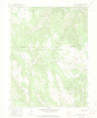
~ Red Elephant Point CO topo map, 1:24000 scale, 7.5 X 7.5 Minute, Historical, 1966, updated 1969
Red Elephant Point, Colorado, USGS topographic map dated 1966.
Includes geographic coordinates (latitude and longitude). This topographic map is suitable for hiking, camping, and exploring, or framing it as a wall map.
Printed on-demand using high resolution imagery, on heavy weight and acid free paper, or alternatively on a variety of synthetic materials.
Topos available on paper, Waterproof, Poly, or Tyvek. Usually shipping rolled, unless combined with other folded maps in one order.
- Product Number: USGS-5355167
- Free digital map download (high-resolution, GeoPDF): Red Elephant Point, Colorado (file size: 6 MB)
- Map Size: please refer to the dimensions of the GeoPDF map above
- Weight (paper map): ca. 55 grams
- Map Type: POD USGS Topographic Map
- Map Series: HTMC
- Map Verison: Historical
- Cell ID: 37324
- Scan ID: 451664
- Imprint Year: 1969
- Woodland Tint: Yes
- Visual Version Number: 1
- Aerial Photo Year: 1965
- Field Check Year: 1966
- Datum: NAD27
- Map Projection: Polyconic
- Map published by United States Geological Survey
- Map Language: English
- Scanner Resolution: 508 dpi
- Map Cell Name: Red Elephant Point
- Grid size: 7.5 X 7.5 Minute
- Date on map: 1966
- Map Scale: 1:24000
- Geographical region: Colorado, United States
Neighboring Maps:
All neighboring USGS topo maps are available for sale online at a variety of scales.
Spatial coverage:
Topo map Red Elephant Point, Colorado, covers the geographical area associated the following places:
- Bloodsworth Pond - Middle Miller Creek - Hay Flat - Miller Creek Cow Camp - Bar H L Park - Red Canyon - Middle Mountain - Big Mountain - T I Cow Camp - Howey Reservoir Dam - Indian Spring - Bar H L Guard Station - Wells Ridge - Trojan Lake - Fourmile Creek - Bloodsworth Spring - Janes Spring - Ute Stock Driveway - Buckskin Gulch - Finley Spring - Howey Reservoir - Machine Spring - Red Elephant Point - Buckskin Lake - Rifle Creek Cow Camp - Hay Flat Trail
- Map Area ID: AREA39.87539.75-107.875-107.75
- Northwest corner Lat/Long code: USGSNW39.875-107.875
- Northeast corner Lat/Long code: USGSNE39.875-107.75
- Southwest corner Lat/Long code: USGSSW39.75-107.875
- Southeast corner Lat/Long code: USGSSE39.75-107.75
- Northern map edge Latitude: 39.875
- Southern map edge Latitude: 39.75
- Western map edge Longitude: -107.875
- Eastern map edge Longitude: -107.75


